
Tag "GIS"

Geospatial Technology to Bring More Tourists to Queensland
GIS People has once again taken out the competition in Queensland Government’s Open Innovation Challenge, and this time won the opportunity to develop an intelligent data management solution for the
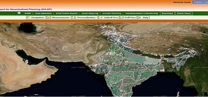
ISRO Empowering Panchayati Raj Institutions using Bhuvan Panchayats
Bhuvan Panchayats Portal plays an important role to disseminate the deliverables of the project including High Resolution Satellite Imagery and Resource Maps at 1: 10,000 scale, to the three levels

Webinar: Geomatica 2014 and LiDAR for Accurate DEM Creation
Geomatica 2014 and LiDAR for Accurate DEM Creation On-demand webinar: Digital Elevation Models (DEMs) play an important role in terrain-related GIS applications. Chief among the many factors that affect the

Dubai Gets Google 360° Street View
According to Khaleej Times, Dubai becomes first city in the Arab region to have Google 360° street view mapping service. The service provides 360 degree views and navigation of streets

India, Russia to Work Jointly on Development of Navigation Platform, GIS
Strengthening their cooperation in the field of space technology, Russia and India today signed an agreement which will enable joint development and implementation of projects like navigation platform and Geographical Information System in India.

University of Denver Offering Master and Graduate Certificate Course in GIS
Founded in 1864—just a few years after the city of Denver itself was founded—the University of Denver is one of the country’s premier private universities. The University’s 125-acre campus, a

Orbit GT Releases Orbit Softcopy Version 11
Orbit GeoSpatial Technologies has released Orbit Softcopy version 11, the photogrammetric mapping solution from the Orbit GT portfolio. “Orbit Softcopy is the first version 11 upgrade within our Photogrammetry portfolio.“, says

Avia-GIS Developed Apps to Combat Diseases Spread by Pests
In recent news by ESA, a consortium led by Avia-GIS in Belgium and supported by ESA has developed Vecmap – an all-encompassing software and services package including a smartphone app for

DoT : GIS Mapping of Telecom Towers
According to recent news by Economic Times, Department of Telecommunications (DoT), Government of India, has asked the telecom service operators in the country to put 584,000 telecom towers on Geographic Information

Webinar Trimble TerraFlex: Introducing Data Update Workflows
Trimble TerraFlex: Introducing Data Update Workflows December 10, 2014 Register for 8am MST (4:00pm Paris) Register for 4pm MST (10:00am Sydney) Trimble® TerraFlex™ software—the flexible, configurable, cross platform solution for
