
Tag "India"
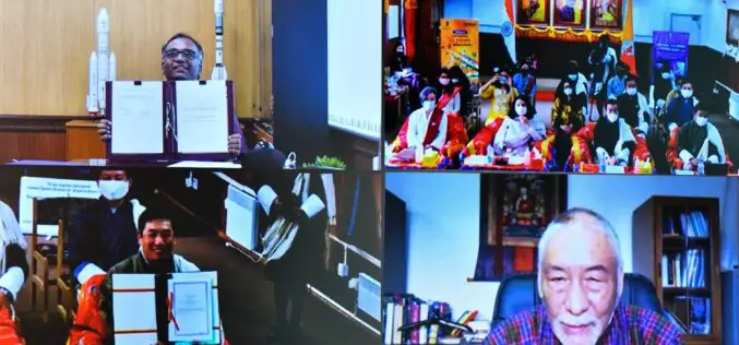
India Signed Arrangement on the Joint development of a Small Satellite for Bhutan
India signed the implementing arrangement on the joint development of a small satellite for Bhutan. The agreement was inked by Shri R Umamaheswaran, Scientific Secretary, Indian Space Research Organisation, and
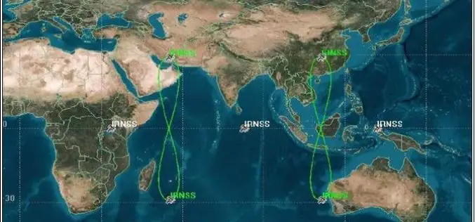
Why India’s Own GPS System 7 Years Late Despite 90% of Funds Allocated Spent
According to recent news by The Asian Age, a report put forward by the Comptroller and Auditor General (CAG) which has pointed at ‘laxity’ on part of the premier space agency

India: Government Added Nine New Names in Smart Cities
January 19, 2018 – New Delhi – Urban Development Minister Hardeep Singh Puri has announced the name of nine more smart cities, taking the total to 99. The mission of hundred

India, Afghanistan to Cooperate in Space Technology
India will widen cooperation with Afghanistan in space technology by extending assistance in remote sensing, a joint statement after the 2nd Strategic Partnership Council Meeting between two nations said. India

Esri Story Map: Unusual Indian Weddings that Challenged Stereotypes
Contributed By:- Here are the wedding stories of young couples and their families who dared to fight stigmas and break stereotypes. These stories rekindle faith in humanity and leave you
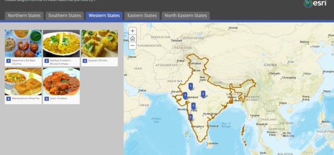
Story Map – Food Specialties of India
Contributed By:- Indian food is different from rest of the world not only in taste but also in cooking methods. It reflects a perfect blend of various cultures and ages.
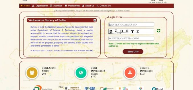
Survey of India Launches Web Portal to Download Maps
According to recent news reported by PTI, the government on Monday launched a website giving people the access to download 3,000 maps prepared by the Survey of India (SoI) but

mApp Your Way – Esri India App Development Challenge
mApp Your Way is an application (mobile or web) development challenge being organized by Esri India. The challenge intends to provide a platform to the institutes and students (UG/PG/Research scholars) to showcase

ISRO Successfully Launched Cartosat-2 Series Satellite Along with 103 Co-passenger Satellites
Sriharikota, India – In its thirty-ninth flight (PSLV-C37), ISRO’s Polar Satellite Launch Vehicle successfully launched the 714 kg Cartosat-2 Series Satellite along with 103 co-passenger satellites today morning (February 15,

OGC Calls for Participation in its Indian Interoperability Plugfest
26 December 2016: The Open Geospatial Consortium (OGC®) is calling to vendors doing business in India for participation in its latest Interoperability Plugfest. The Department of Science and Technology (DST),
