
Tag "mapping"

Geospatial Technology to Achieve 11th Malaysia Plan
Geospatial technology will play a crucial role in helping agencies achieve the goals set out in the 11th Malaysia Plan (RMK11), according to a panel of Malaysia’s most influential industry
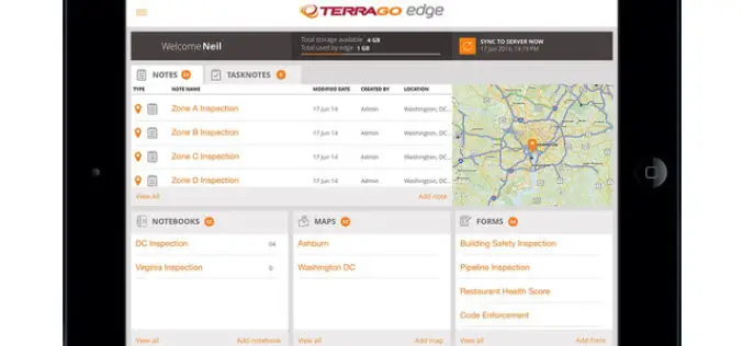
TerraGo Edge Version 3.9.5 Adds New Tools for Advanced Mapping and Field Data Collection
New Enhancements Improve Quality of Data & Efficiency of Field Work Available today, TerraGo Edge version 3.9.5 provides new tools to improve field data collection and further enhance mobile GPS
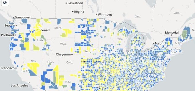
Mapping Broadband Health in America
The Connect2Health Task Force’s Mapping Broadband Health in America tool allows users to visualize, overlay and analyze broadband and health data at the national, state and county levels – informing policy
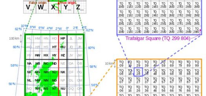
Is Britain on the move?
Australia has recently announced a 1.8m shift in its mapping coordinates, to compensate for the country’s 7.5cm shift north each year. Inevitably the question is why, and could the same
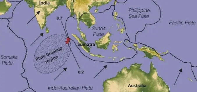
Australia’s Coordinates out by More Than 1.5 m
The Australian continent tectonic plate is moving 7 cm a year (and colliding with the Pacific Plate, which is heading west 11 cm a year) and experts at Geoscience Australia

Egypt to Map Archaeological Sites
A map of all of Egypt’s archaeological sites and museums has been created and will be launched for the first time on sites around the country The Geographic Information System

Gwalia Surveyors Introduces New 3D BIM Utility Mapping Technology
London, UK – July 26, 2016 /– Gwalia Surveyors, a multi-disciplinary survey consultancy committed to providing detailed survey data for their clients, has recently introduced new 3D Building Information Mapping (BIM)
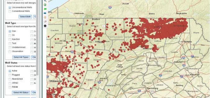
Pennsylvania Launches New GIS Application and Tutorial to Help Users Find Oil & Gas Well Mapping Information
Harrisburg, PA – The Department of Environmental Protection (DEP) today released an updated version of a GIS application that allows users to learn information and download reports about oil and
Online Map Tool Helps You to Design a Better Map
Many cartographers are often anxious about creating a map that is not attractive enough. In the latest updated version of SuperGIS Desktop 3.3 and 10, Supergeo will support users to
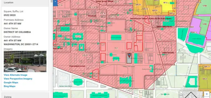
Blue Raster Incorporates Esri Technology into DC Office of Zoning Map
Constituents Can Leverage Open Data through Mobile Devices for Easy Access to Detailed Zoning and Planning Information Redlands, California—Esri has announced that the Washington, DC, Office of Zoning (DCOZ) has released
