
Tag "mobile GIS"
SuperSurv 3.2 Release Advanced GPS Support and Data Collection Functions
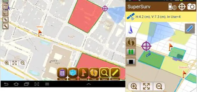
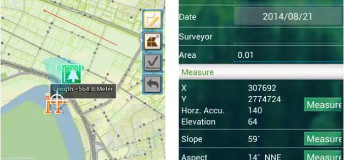
Developed by Supergeo, the latest version of SuperSurv (Android) 3.2 is upgraded with stronger data collecting function by GPS and more precise and easy-to-use GPS manipulation interface, bringing

SuperGIS Supports Orienteering Club Charity Map Projects
Supergeo Technologies, the global leading GIS software and solution provider, announces that Star Vision Ltd., Supergeo Certified Reseller in Hong Kong, Macau and Guangdong, utilizes SuperGIS in a charity map
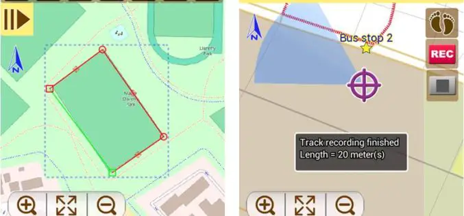
Latest SuperSurv 3.2 Boosts Convenience of Geospatial Data Collection
Developed by Supergeo, the latest version of SuperSurv (iOS/Android) 3.2 is upgraded with more global coordinates systems functions to bring users a more convenient and intuitive manipulation. SuperSurv, the mobile
The Latest SuperGIS Server 3.2 Upgraded for Enhanced Service Management and Efficiency
The newest version of SuperGIS Server 3.2, developed by Supergeo, is now launched to global users. The new edition provides enhanced user interface and service management workflow, to assist developers

SuperGIS Assists South Africa in Economy Planning and Development
Supergeo Technologies, the global leading GIS software and solution provider, announces that Mangaung Metro Municipality (MMM), South Africa, utilizes SuperGIS Desktop and SuperSurv to evolve the city economic development. The
Supergeo to Release Forest Inventory App for Android Users
Forest Inventory App, an Android app designed for forest information collection, developed by Supergeo, will be released to provide forest investigators with a professional and handy tool for field survey
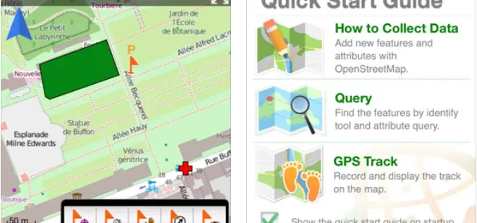
Mapping and Collecting Geospatial Data with SuperSurv 3.2 (iOS)
Supergeo Technologies Inc, the leading global provider of GIS software and solutions, announced that SuperSurv 3.2 (iOS), professional mobile GIS App, supports French user interface and Lebanese coordinate system. The

SuperSurv 3.2 Beta Launched for Intuitive GIS Data Capture
Supergeo launched SuperSurv 3.2 (Android) Beta for global users. The new app will possess more practical functions, enhance user interface and improve query and way point efficiency, providing users with

CoreLogic Releases New Natural Catastrophe Risk Models
––EQECAT RQE v15.0 Platform Includes New Windstorm, Earthquake and Tsunami Risk Models –– CoreLogic® (NYSE: CLGX), a leading global property information, analytics and data-enabled services provider, today released a new

SuperSurv M3 Flash Sale for Cost-Effective Field Data Collection
Supergeo Technologies, a leading global provider of GIS software and solutions, announces that SuperSurv M3, the professional mobile GIS app for Android and iOS powered devices, is now on 50%
