
Tag "NASA"
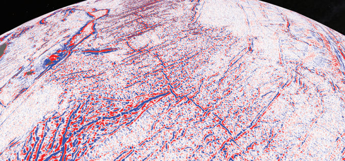
Satellite Maps Reveal Small Tectonic Plate in the Indian Ocean
A team of Australian and U.S. researchers has found a small tectonic plate or microplate in the Indian Ocean. Using Satellite maps, researchers discovered the Indian Ocean microplate, called Mammerickx Microplate and measuring
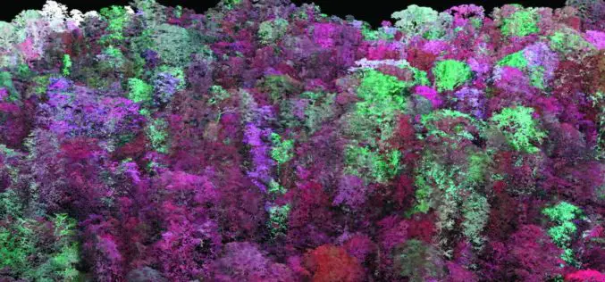
Laser Based Forest Mapping Instrument for Space Station
Laser-based technology will enable unprecedented measurements of 3-D forest structure A laser-based instrument for mapping the 3-D structure of Earth’s forests has passed a major milestone toward deployment on the
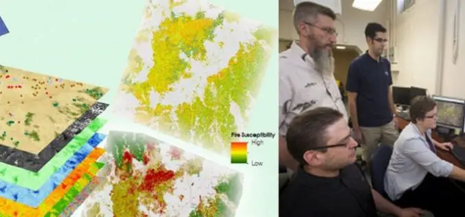
A Landsat based Tool to Map Wildfire Hazard and Susceptibility
Wildfires, coupled with the presence of invasive plant species, are primary drivers of change in semi-arid savanna ecosystems. These wildfires disrupt ecosystems, human localities, critical habitats of the endangered Greater

ARSET Training Announcement: Remote Sensing for Wildfire Applications
Remote Sensing for Wildfire Applications (in-person workshop) October 6-8, 2015 Idaho State University, Pocatello, Idaho, USA Workshop Overview: The ARSET team is gearing up for an in-person training titled “Remote

NASA Air Quality Remote Sensing Training for SESARM & GEPD
The goal of the NASA Applied Remote Sensing Training (ARSET) is to increase the utility of NASA earth science and model data for policy makers, regulatory agencies, and other applied
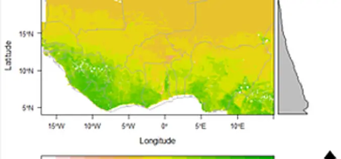
Space Technology Identifies Vulnerable Regions in West Africa
University of Leicester researchers in collaboration with NASA use satellites to map land degradation in Sub-Saharan West Africa A group of international researchers led by the Centre for Landscape and
NASA Training on Remote Sensing Observations for Flood Management
The goal of the NASA Applied Remote Sensing Training (ARSET) is to increase the utility of NASA earth science and model data for policy makers, regulatory agencies, and other applied
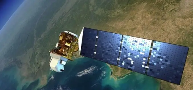
Landsat 9 to Continue Land Imaging Legacy of the U.S. Space Program
In recent news update by NASA, NASA and USGS are working together on Landsat 9, schedule to launch in 2023. NASA will build, launch, perform the initial check-out and commissioning
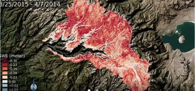
NASA: California Tuolumne Snowpack 40 Percent of Worst Year
New NASA data find the snowpack in the Tuolumne River Basin in California’s Sierra Nevada — a major source of water for millions of Californians — currently contains just 40
NASA ARSET Course on Introduction to Remote Sensing for Conservation Management
The goal of the NASA Applied Remote Sensing Training (ARSET) is to increase the utility of NASA earth science and model data for policy makers, regulatory agencies, and other applied
