
Tag "Pix4D"
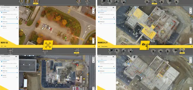
6 Major Construction Companies Adopt New Bim Monitoring Solution
Construction professionals understand that daily visualization of a job site helps minimize construction delays, prevent clashes between as-built and as design, eliminate the need for rework, facilitate stakeholder communication and
Comparable Maps, Anytime, Thanks to Pix4D and Sequoia Sunshine Sensor
Consistent Index Maps When you are a service provider with high client expectations, you need to be able to obtain quality results on a regular basis. When it comes to
Evolving Photogrammetry from Single-Pair Stereo to Multi-View rayCloud
Pix4Dmapper Pro’s rayCloud is a full-3D interface which allows visualization and analysis based on multi-ray intersections from 2D images. This provides a more accurate and consistent solution than extracting 3D

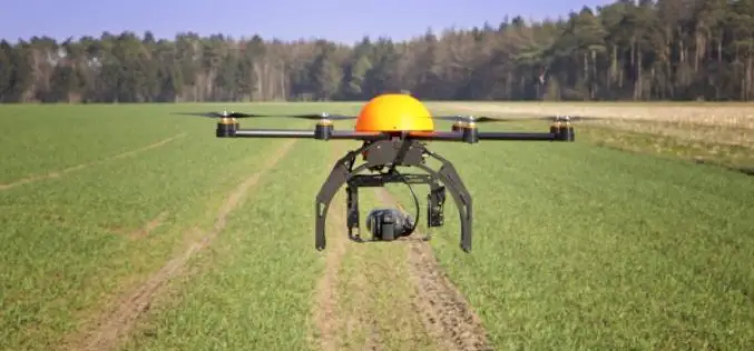
The Power of Offline Processing: Why Desktop is Essential for Drone Mapping in Agriculture
Part 2: Processing in the Field In Part 1 of this mini-series we went over why it makes sense in agriculture to import images directly to Pix4Dag Desktop. We concluded that
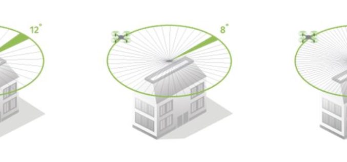
How Do I Choose the Right Image-capture Settings for 3D Models?
How do I choose the right image-capture settings for 3D models? What are the effects of the “angle between images” setting in circular missions when it comes to 3D reconstruction?
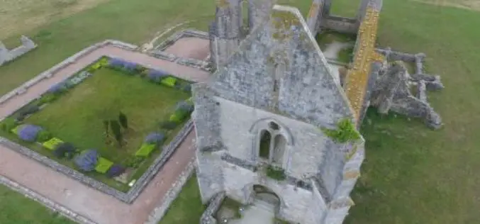
Leveraging 3D Modeling and Printing Skills as a Service: Mapping the Abbey of Chateliers and Church of Ars-en-Ré
In order to explore how to better expand and improve their services, French photography and photogrammetry-based service provider Unautregard teamed up with Planète Sports &Loisirs and 3D Arcwest, to capture,

In Defense of Desktop: Why Desktop is Essential for Drone Mapping in Agriculture
Part 1: How quickly can you go from landing to processing? If you want an NDVI map while you’re still in the field, cut out a potentially long upload to
Drones in Agriculture and Hands-On Drone-to-GIS Workflows
Hands-On Drone-to-GIS Workflows Sponsored by the Michigan State University Institute of Agricultural Technology, in coordination with RS&GIS and Northwest Michigan College. This unique and comprehensive, instructor-led training course is taught
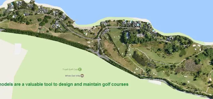
Three Reasons Golf Courses Are the Next Drone Mapping Territory
The emerald golfing greens have seen better days. According to the US National Golf Foundation, the number of players has almost steadily declined from over 30 million in 2005 (pre-recession),

What’s New in ArcGIS Earth 1.2
ArcGIS Earth is off to a great start with thousands of downloads and an engaged community of global users. We are happy to release the 1.2 version and excited to
