
Tag "remote sensing"
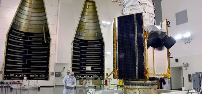
DigitalGlobe Announces the Successful Launch of WorldView-4 – Doubles DigitalGlobe’s Earth Imaging Capacity
WESTMINSTER, Colo.–(BUSINESS WIRE)–DigitalGlobe, Inc. (NYSE: DGI), the global leader in earth imagery and information about our changing planet, today announced the successful launch of WorldView-4, the company’s newest high-accuracy, high-resolution

USDA Funds Bodkin Design to Develop UAV Sensor for Precision Agriculture
Bodkin Design & Engineering, LLC has been awarded a $100,000 contract from the U.S. Department of Agriculture (USDA) to develop a compact hyperspectral imager for UAV platforms. This unique camera

Iran Defines 7 Projects to Use Remote Sensing for Monitoring Agriculture
According to recent news by the Mehr news Agency, the Iranian Space Agency has defined 7 mega projects in the field remote sensing for monitoring agricultural products with high precision. Mohammad
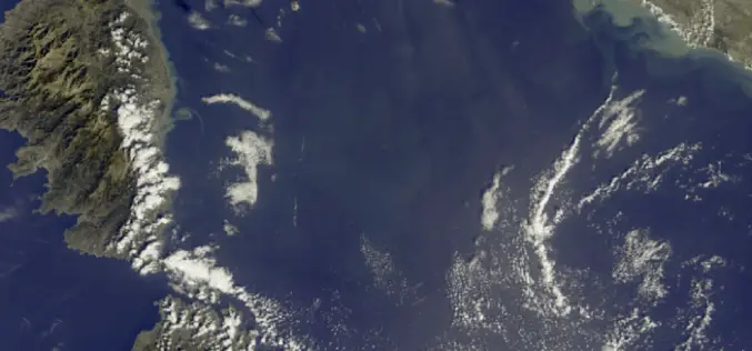
First Earth Colour Data Released by Sentinel-3A
20 October 2016 – The Copernicus Sentinel-3A satellite has taken another step towards being fully ‘operational’ as the first data from its Ocean and Land Colour Instrument are made available
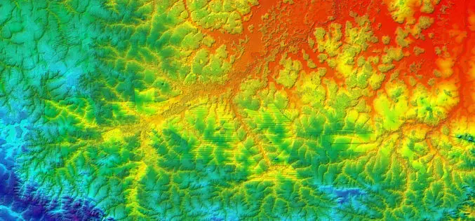
Benefits and Potential of RADAR Satellites: TerraSAR-X and TanDEM-X
The German satellite duo TerraSAR-X and TanDEM-X have consistently delivered one-of-a-kind Earth observation data since 2007 and 2010, hence shaping the international research landscape. TanDEM-X is being implemented on behalf of
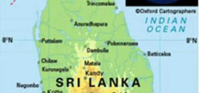
Sri Lanka Setting Up National Spatial Data Infrastructure for Development
According to recent news, Sri Lanka’s Survey Department is setting up national spatial data infrastructure where spatial or location-based information can be better used and shared by both the government
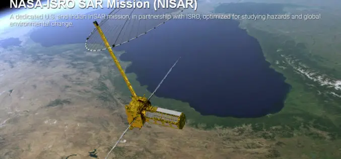
Opportunity for Young Scientist to be a Part of NASA-ISRO Synthetic Aperture Radar (NISAR) Data Program
AHMEDABAD: Here is a chance for young scientific researchers and data crunchers to be part of Isro’s ambitious NASA-ISRO Synthetic Aperture Radar (NISAR) satellite data analysis program. This will be
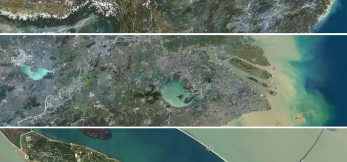
Release of PlanetSAT 15 L8 imagery Basemap of Asia by PlanetObserver
Clermont-Ferrand, 12 October 2016 – The French company PlanetObserver, specialized in imagery basemap production for more than 25 years, announced today the coverage of Asia with PlanetSAT 15 L8 basemap,

Increased Use of Satellite Monitoring on the Norwegian Shelf
NOFO (Norwegian Clean Seas Association for Operating Companies) and KSAT (Kongsberg Satellite Services) has signed an extended agreement for satellite-based remote sensing, on the Norwegian Continental Shelf, for detection of

Iran Signed Deal on Remote Sensing Satellite Signed by Russia
TEHRAN, Oct. 02 (MNA) – ICT minister Mahmoud Vaezi said the final agreement for the construction and launch of the National Remote Sensing Satellite has been signed by the Russian satellite
