
Tag "Satellite imagery"
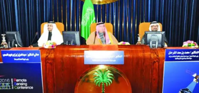
Saudi Arabia to Use ‘LIDAR’ for Satellite Imagery
Inaugurating the first International Remote Sensing Conference in Saudi Arabia at the King Faisal Hall on Sunday, the Prince Turki bin Saud bin Mohammed Al-Saud, Saudi Arabia said the King

GAIL to Use Drones, Satellite Mapping To Monitor Pipeline Network
GAIL (India) Ltd has decided to use drones and satellite imagery to map and monitor its pipeline network while expanding its Sahyogi (partner) scheme to detect/prevent encroachment and terror attack
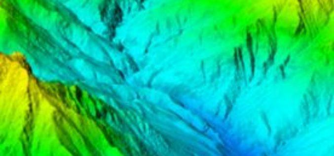
Vricon Introduces Groundbreaking Medium-resolution Digital Surface Model
November 10, 2015 – Vricon releases a medium-resolution global digital surface model (DSM) for $1.99 per km2 that defines a new industry standard for this product class. Vricon DSM-10 is

OpenStreetMap for Emergency Response
This past week was intense – the most powerful hurricane ever recorded in the Western Hemisphere made landfall, just missing major population centers and avoiding catastrophic damage. Three days later,
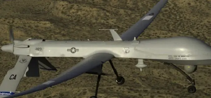
Drone Bombings in the Federally Administered Tribal Areas: Public Remote Sensing Applications for Security Monitoring
Drone bombing, as a US defense strategy in Pakistan, began under the George W. Bush administration as part of the “US War on Terrorism” and aimed to defeat Taliban and

Esri Webinar: Reveals New Methods of Imagery Change Detection
The Art and Science of Imagery Change Detection Wed, Oct 21, 2015 10:30 PM – 11:30 PM IST Show in My Time Zone The only thing constant is change. This
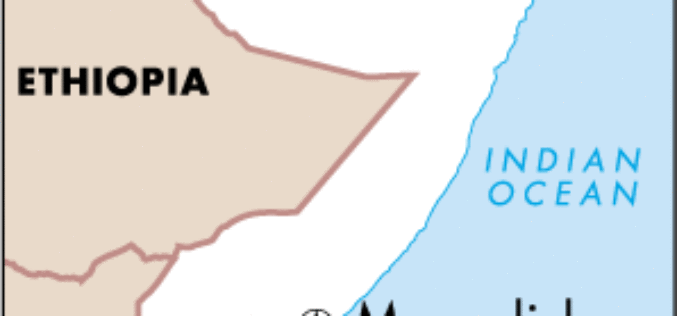
Remote sensing, Satellite Imagery, Surveys Use to Estimate Population of Mogadishu
The results of the first population survey of Mogadishu, Somalia, conducted in a quarter century were presented today at a session of the 2015 Joint Statistical Meetings (JSM 2015) in
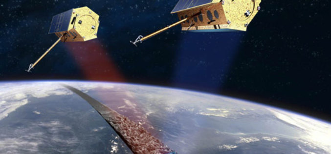
Free Provision of TerraSAR-X and TanDEM-X Data for Government Studies and Professional Training in Canada
Airbus Defence and Space has signed an agreement with the Canada Centre for Mapping and Earth Observation (CCMEO) providing Canadian governmental and institutional data users free access to TerraSAR-X and
Proteus Announces Launch of Professional Satellite Image Procurement Service
Proteus, a provider of satellite derived mapping and geospatial services, announces the official launch of their new professional satellite image procurement service. Proteus employ dedicated expert account managers to provide

Supergeo Confirms Dealership with National Space Organization for FORMOSAT-2 Satellite Imagery
Supergeo Technologies, the leading GIS software and solution provider, announces an agreement with National Space Organization (NSPO), Taiwan to resell the satellite imagery of FORMOSAT-2. The 891 km-above-ground FORMOSAT-2 is
