
Tag "Spatial data"

Abu Dhabi Municipality Launches GIS Platform for Submittal of Road Layout Data
In a major boost and expansion to the e-services, The Abu Dhabi City Municipality (ADM) has launched a platform that allows submittal of roads layout data standards using Geographic Information

Bangladesh Govt to Form National Spatial Data Infrastructure (NSDI)
According to recent news, Prime Minister Sheikh Hasina has said her government would soon form ‘National Spatial Data Infrastructure’ (NSDI) to generate geo-data and digital mapping aimed at country’s planned development.

New Esri Workbook Teaches Basic Mapmaking and Spatial Analysis Techniques
Redlands, California—The new edition of GIS Tutorial 1: Basic Workbook, published by Esri, teaches the fundamentals of using geographic information system (GIS) technology, including making maps, geocoding data, and analyzing
Korea to Launch Spatial Data Infrastructure Building Projects in Central Asia, Africa
According to recent news by Business Korea, The National Geographic Information Institute (NGII) is planning to launch spatial data infrastructure (SDI) building projects in Kazakhstan, Kyrgyzstan, Uzbekistan and Mongolia. The
OGC Requests Information to Guide Arctic Spatial Data Pilot
The Open Geospatial Consortium (OGC®) requests information to help advance the “Arctic Spatial Data Pilot”. The Arctic Spatial Data Pilot is an OGC Interoperability Program initiative sponsored by the U.S.

GeoMesa 1.2: Now with Eclipse LocationTech Vetting!
Release 1.2 of GeoMesa, our open source suite of geospatial analytics tools designed to run with Hadoop-scale volumes of data, is now out. Along with several new features, this is

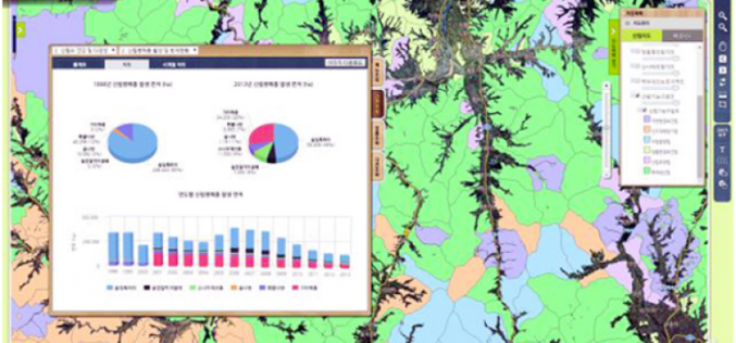
Korean Geotechnology Company Selects SuperGIS Desktop to Process Spatial Data
Supergeo Technologies Inc., the total GIS software and solution provider announces that Nexgeo has selected SuperGIS Desktop for processing and visualizing geospatial data. Headquartered in Seoul, Nexgeo is a Korean consulting

Russia Federal Law On Geodesy, Cartography and Spatial Data
According to recent news, Russian President Vladimir Putin signed Federal Law On Geodesy, Cartography and Spatial Data and on Amendments to Certain Legislative Acts of the Russian Federation. The Federal Law regulates relations arising as a result of carrying out geodetic

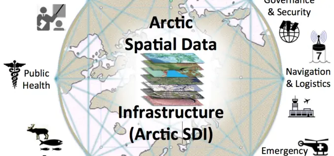
OGC Announces New Arctic Spatial Data Infrastructure Project
The Open Geospatial Consortium (OGC®) announces a new OGC Interoperability Program project called the “Arctic Spatial Data Infrastructure Standards and Communication Pilot” (Arctic SDI Pilot). The Arctic SDI Pilot is

Trimble Introduces Next Generation Indoor Mobile Mapping System for Building Interiors and Underground Structures
TIMMS 2—Smaller, Lighter and Easier to Maneuver System Maximizes Performance in Indoor Spaces While Delivering Accurate, High-Quality Data SUNNYVALE, Calif., Sept. 29, 2015—Trimble (NASDAQ: TRMB) introduced today its next generation Trimble®
