
Tag "UAV"
Haryana Government Sanctioned Rs 1.93 Crore Innovation Fund
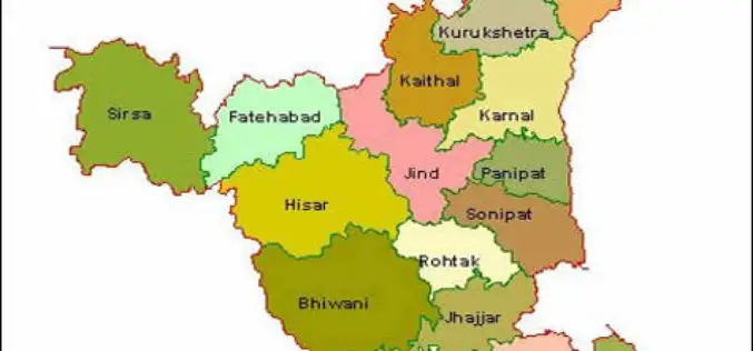
In recent news, the Haryana government has sanctioned innovation funds of over Rs 1.93 crore to four districts namely Faridabad, Gurgaon, Karnal and Kurukshetra. Sumita Misra, principal secretary, science and
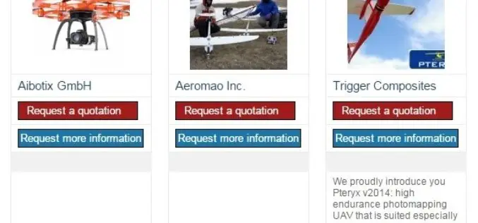
The 5most viewed UAVs for Mapping and 3D Modelling on Geo-matching.com
The Geo-matching.com website features a selection of the most important geomatics equipment, including UAS for Mapping and 3D Modelling. At www.geo-matching.com you can compare product specifications and read users’ reviews
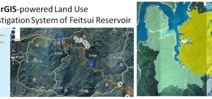
GIS Observation System Supplies Water for Lives
As the main water supply and electricity generator in great Taipei, Feitsui Reservoir is a vital resource in Taiwan. Feitsui Reservoir Administration therefore needs to ensure that water quality, water

SimActive Launches Version 6.0 with Revolutionary Photogrammetric Workflow
SimActive Inc., a world-leading developer of photogrammetry software, is pleased to announce Correlator3D™ version 6.0. A revolutionary new interface introduces streamlined image processing for any sensor type. New features include
One Week Course About UAV Remote Sensing Principles
It is a one week course about state of the art remote sensing techniques using UAV aerial images. A broad board of top level UAV professionals and researchers has been

RIEGL adds RiCOPTER with VUX-SYS to Geo-matching.com
The RiCOPTER is a ready to fly remotely piloted airborne laser scanning system is a high-performance UAV which can be equipped with the RIEGL VUX-1 survey-grade LiDAR sensor to offer

LizardTech to Demonstrate a UAV Workflow at the Esri Southwest User Conference
SEATTLE, Wash. – LizardTech®, a provider of software solutions for managing and distributing geospatial content, will give a UAV oriented presentation at the Esri Southwest User Conference in Sante Fe,
Chinese Remote Sensing Drone Sets 30-hour Flying Record
A new Chinese unmanned aerial vehicle (UAV) set a new record for the country’s remote sensing drones by flying for more than 30 hours consecutively, the UAV’s developer, the Chinese
SimActive’s Software Purchased by Mexican Firm IMT
SimActive Inc., a world-leading developer of photogrammetry software, is pleased to announce that Mexican firm IMT Latinoamericana S.A. de C.V. has purchased its Correlator3D™ product. The transaction was brokered by
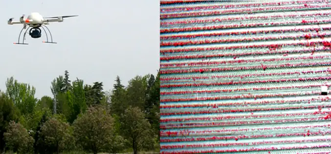
Weed Mapping in Maize Fields Using Unmanned Aerial Vehicle (UAV) Images
Weed Mapping in Early-Season Maize Fields Using Object-Based Analysis of Unmanned Aerial Vehicle (UAV) Images Today I was doing google about UAV and I came across a awesome work by José
