Increase the Return on Your GIS Investment with GIS-Lite Applications
July 14, 2015
12:00-12:30 PM ET
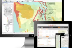
 Deliver self-contained, interactive maps and lightweight GIS applications available to all end users with free, universally available software.
Tap into the power of OGC’s GeoPackage, the industry’s open geospatial database standard. With TerraGo, users can create GeoPDF maps and embed feature attributes as a GeoPackage database. This allows them to share interactive maps and applications with TerraGo Toolbar users, anytime, anywhere.
Join this webinar and learn how OpenGeoPDF can radically change, enhance and optimize your workflows, allowing non-GIS users to access all of the information needed and making the most out of your GIS investment.
Join Webinar Now
About TerraGo
TerraGo makes software that makes it easy for our customers to collect data, share information and work together anywhere, any time. From sharing feature-rich maps and imagery to deploying on-demand apps for a mobile workforce, TerraGo builds intuitive products that enable collaboration from any place on the planet.
Founded in 2005, TerraGo invented the industry’s most widely adopted geospatial collaboration technology with its innovative GeoPDF products and revolutionized field data collection with its TerraGo Edge mobile platform.