
Archive
NOAA’s Online Mapping Tool ERMA Opens up Data to the Public
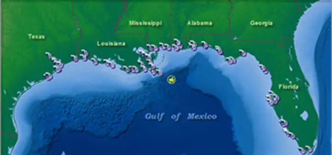
NOAA’s Environmental Response Management Application (ERMA) is a web-based mapping application that pulls in and displays both static and real-time data, such as ship locations, weather, and ocean currents. ERMA enables

RMIT University is Offering Doctorate, Master and Diploma Courses in Geospatial Science
RMIT is a global university of technology and design. Founded in 1887, it is now the nation’s largest tertiary institution, with 74,000 students. RMIT has three Melbourne campuses, two campuses
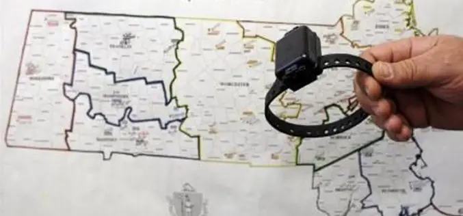
Saudi Attaches GPS-Enabled Bracelet to Those Intend to Join Terrorists
Saudi Arabia has started attaching GPS-enabled electronic bracelets to “those who intended to join terrorist groups abroad”, in a bid to monitor their activities. Eisa Al-Ghaith, a judge and member

Improve Underground Utilities Management and Public Safety by 3D GIS
Developed by Supergeo Technologies, SuperGIS 3D Earth Server is going to support underground utilities management. The breakthrough tech enables administrators to comprehend the distribution of underground utilities that cannot be
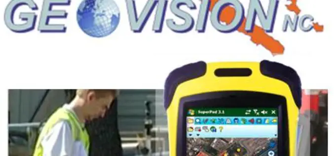
GEOVISION Utilizes SuperGIS for Maritime and Land GIS Planning
Supergeo Technologies Inc., the leading GIS software and solution provider, announces that GEOVISION, Nouvelle-Calédonie, selects cross-platform SuperGIS series products, SuperGIS Desktop, SuperSurv and SuperVeyor, to elevate its maritime and land

Webinar: Turn Your Mobile Device Into Survey Grade GPS
Turn Your Mobile Device Into Survey Grade GPS March 24, 2015, 12:00 – 12:30 PM ET There’s no need to continue to pay tens of thousand of dollars on single-use proprietary

Webinar: ArcGIS 10.3 – What’s New?
Esri India Webinar: ArcGIS 10.3 – What’s New? 24th March 2015, 11:00 AM IST onwards ArcGIS 10.3 is a major release that will help you discover, make, use, and share

Learn Web GIS, Step by Step
Redlands, California—The growing popularity of web maps and apps calls for a workforce well versed in building them. That’s why Esri has published Getting to Know Web GIS, a new
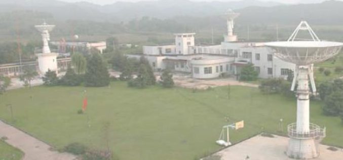
China to Setup Satellite Data Receiving Station in the Arctic
In a recent news by CRI English, China is working to setup its first overseas satellite data receiving station in the Arctic. The station, which is expected to start operation

Survey Earth in a Day 4D
Survey Earth in a Day 4D June 21, 2015 – 4th Annual Global Celebration of the Land Surveying Profession Welcome Surveyor! At Noon, on the day of the solstice, June 21,
