
Archive

Fifteen Years of Disaster Relief From Space – Global Patterns and Trends
14 July 2016 – Today, the analysis and use of satellite images is commonplace. Just 15 years ago, however, only a handful of specialists worked with these valuable data. Since then,

Singapore Housing & Development Board Leverages Geospatial Technology for Land Use Planning
Since land-use planning is vital in a land-scarce Singapore, the republic’s Housing & Development Board (HDB) has leveraged Geographic Information System (GIS) technology in its Integrated Planning and Analysis system
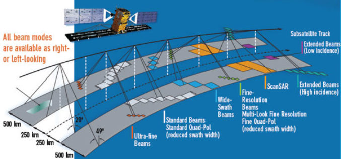
EMSA Expands Use of RADARSAT-2 Information for Maritime Applications
Richmond, BC – MacDonald, Dettwiler and Associates Ltd. (“MDA” or the “Company”) (TSX: MDA), a global communications and information company, has recently (July 13, 2016) announced that it has signed

25 Years Ago – Europe’s First Earth Observation Satellite Was Launched
• First European radar satellite ERS-1 revolutionised satellite Earth observation by revealing never before seen details • ERS satellite programme laid the foundations for modern radar satellite technology and applications
Geographic Calculator 2016 Now Supports Petrel Database Files
Blue Marble Geographics is pleased to announce the immediate availability of Geographic Calculator 2016 Service Pack 1 (SP1). This intermediate release includes array of functional upgrades, usability improvements, and new
Iran to Launch up to Two Satellites by the End of This Persian Year
According to recent news by the TECHRASA, the Head of Iranian Space Agency had recently announced that Iran would launch up to two satellites by the end of this Persian year.
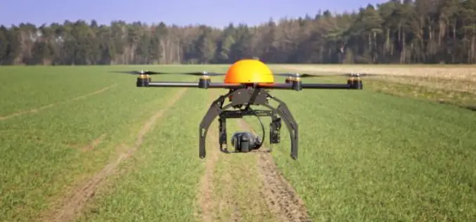
Agricultural Drone Market Size Anticipated to Achieve Over USD 555 Million at a CAGR of 21% from 2016 to 2023
According to a market research report published by Global Market Insights, the agricultural drones market size was valued over USD 135 million in 2015 and is anticipated to achieve over

China Developing Water Cycle Observation Satellite to Monitor Hydrological Events
According to recent news by PTI, China will launch its first geoscientific satellite by 2020 for forecasting hydrological events, including floods and droughts. China announced its plans for the Water

Hexagon Showcases Geospatial Enterprise Solutions at ISPRS 2016
Hexagon AB, a leading global provider of information technologies that drive productivity and quality across geospatial and industrial enterprise applications, will showcase its geospatial enterprise solutions at XXIII ISPRS (International
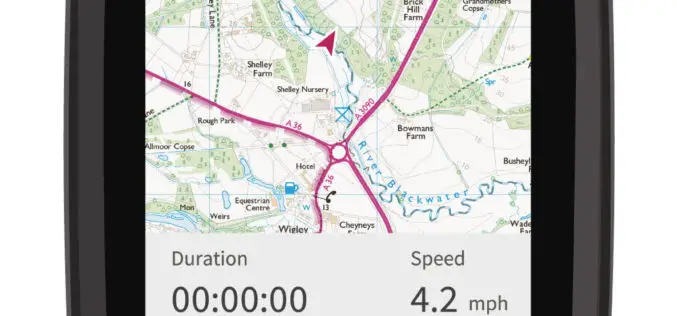
CompeGPS and Ordnance Survey Team Up to Produce the ‘OS Range of GPS Units’
Ordnance Survey (OS) and CompeGPS are pleased to announce a new partnership to release a range of outdoor activity GPS units. The exciting move is being made ahead of the leading
