
Archive

GPS and Satellite Mapping Technology to Monitor the Forest Cover
Maharashtra, India – Maharashtra government will use Global Positioning System (GPS) and satellite mapping technology to monitor the forest cover in the state. “The government will use GPS and satellite
Scientists Develop Air-pollution Warning Software Using Satellite Images
Vietnam – According to recent news by the VietNamNet Bridge, Scientists from the Hanoi University of Engineering & Technology, a member school of Hanoi National University, have invented an air pollution warning
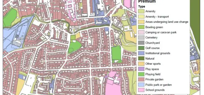
New Dataset of Accessible Greenspace for Scotland
A new digital map of every publicly accessible greenspace in Scotland will be released in March 2017. Recently the Ordnance Survey (OS) and the Scottish Government released an update on the project
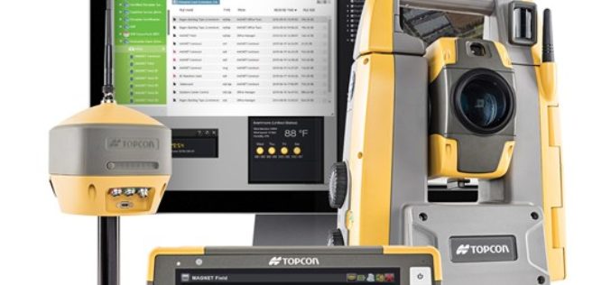
Topcon Introduces Elite Survey Suite
Speed, ease-of-use and integration key to design LIVERMORE, Calif., USA/ CAPELLE A/D IJSSEL, The Netherlands – June 30, 2016 –Topcon Positioning Group announces a new suite featuring four integrated solutions

China Estimates Decline in Summer Crop Yield
According to recent news by The Institute of Remote Sensing and Digital Earth (RADI) under the Chinese Academy of Sciences (CAS), China’s summer crop yield is set to drop for

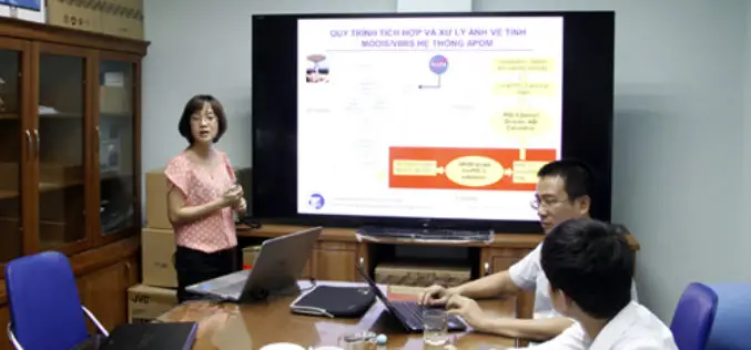
Access Cadastral Data by One Click!
Cadastral data is a combination of real estate registry and metes-and-bounds, including attributes like ownership, precise location, area, and land value. It is an important and fundamental data source in
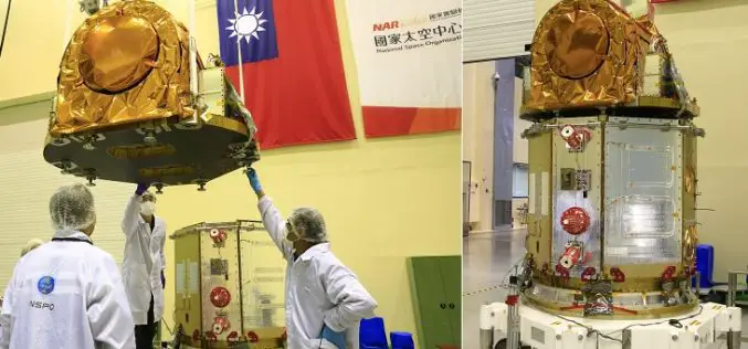
Taiwan to Use Japan’s Satellite Services Until FORMOSAT-5 is Launched
According to recent news by the Taipai Times, Taiwan would seek to use Japan’s satellite services until its newest satellite, the FORMOSAT-5, can be launched later this year. Minister of

EUFAR/ ESA Expert Workshop on Atmospheric Correction of Remote Sensing Data
An expert workshop on atmospheric correction of remote sensing data will be held from 26 to 28 October 2016 at the Harnack Haus of the Max Planck Society, in Berlin, Germany.
Esri Fosters Industry Innovation with Unique Startup Program
Initiative enables top startups to incorporate location analytics into their products and develop breakthrough solutions June 30, 2016-Redlands, California—Esri, the world’s leading mapping platform company,continues to foster industry innovation and

Trimble R2 GNSS Receiver Now Available for Data Collection
Collecting Professional Data Made Easier With Trimble R2 GNSS Receiver June 29, 2016 – Redlands, California—Esri announced today the availability of the Trimble R2 Global Navigation Satellite System (GNSS) receiver for
