
Archive
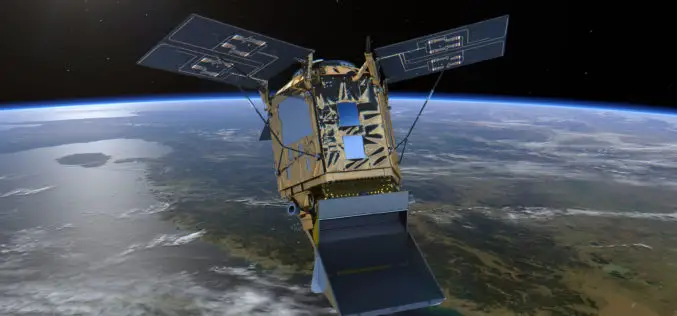
Sentinel‑5P – First Copernicus Mission Dedicated to Monitoring Our Atmosphere
October 13, 2017 – The first Copernicus mission dedicated to monitoring our atmosphere, Sentinel‑5P, has been launched from the Plesetsk Cosmodrome in northern Russia. Sentinel-5P belongs to the Copernicus satellite fleet,
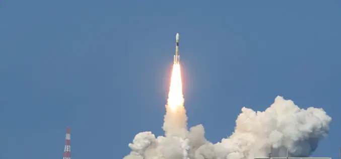
Japan Successfully Launches 4th Satellite of Quasi-Zenith Satellite System (QZSS)
October 10, 2017 – Mitsubishi Heavy Industries, Ltd. and JAXA successfully launched H-IIA Launch Vehicle No. 36 (H-IIA・F36) which encapsulates MICHIBIKI No. 4, Quasi-Zenith Satellite System; at 7:01:37a.m., 2017 (JST) from

3D Modeling to Plan Development Projects in Jaipur City
Jaipur, India – According to recent news reported by the TOI, the Department of Information Technology and Communications (DIoTC) of Jaipur, has undertaken an ambitious ‘3D City Model’ project. The
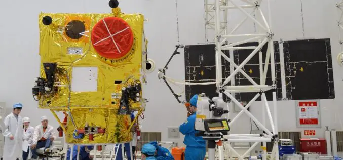
China Launched the 2nd Remote Sensing Satellite for Venezuela
According to recent news reported by Sputnik, China launched the second Venezuela Remote Sensing Satellite (VRSS-2) using a Long March-2D (Chang Zheng-2D) launch vehicle on October 09, 2017. Also known by

Remote Sensing Technology to Protect Frankincense Trees
According to recent news by Muscatdaily.com, the Remote Sensing and GIS Research Center (RSGISC) at the Sultan Qaboos University, Muscat, is assessing the use of remote sensing and GIS technology in
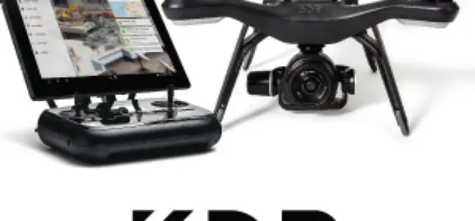
Register for the 3DR Site Scan Training Webinar
Join 3DR for the Site Scan Manager Training Webinar on Wednesday, October 11th, at 10:00 am PDT (convert to your timezone) 3D Robotics is an American company headquartered in Berkeley, California that provides enterprise

Geovation Challenge: Turn Your Great Idea into a Great Business
If you’re a UK start-up and want to help solve pressing issues using location information; the Challenge could be perfect for you. You might be an innovator with a passion for

ESA Invites Proposals to Promote Scientific Exploitation of Satellite Data
ESA’s EO Science for Society programme aims to promote scientific exploitation of satellite data, pioneer novel applications and develop pre-commercial services while maximising the use of information and communications technologies. In
Pakistan to Launch First Remote Sensing Satellite in 2018
According to recent news by the Geo.tv, the Pakistan Space and Upper Atmosphere Research Commission (Suparco) has recently announced that Pakistan’s first optical remote sensing satellite PRSS-1 would be launched in 2018. The
Hexagon Acquires Luciad, a Leading Provider of 5D Visualisation and Analysis Solutions
04 October 2017 – Stockholm, Sweden – Hexagon AB, a leading global provider of information technologies that drive productivity and quality across geospatial and industrial enterprise applications, announces the acquisition of Luciad,
