
Posts From GIS Resources

Israeli Initiative for Online Mapping of Air-raid Shelters
Israeli authorities has initiated a call for crowd source mapping of air-raid shelters on Google Maps, as well as in the form of softwares for use by other applications. Availability of

Icaros to Unveil Oblique Image Viewer and Measuring Tool for ArcGIS
FAIRFAX, Virginia, USA, – Icaros Inc. (Icaros), a leading provider of advanced aerial remote sensing and 3D visualization solutions, will introduce the Icaros Measurement Tool (IMT), a simple but powerful

Webinar: Advances in Geodesy and GNSS
Webinar on “Advances in Geodesy & GNSS: Opportunities and Challenges for the Surveying Industry” Wed, 23 Jul 2014 at 1300 – 1400 hour SSSI NSW are proud to present a webinar

University of Hawaii Offers Certificate Course in GIS
The University of Hawaii is now offering a Certificate of Competence in Geographic Information Systems (GIS)! The course is offered on Maui, Kauai, and Hawaii Island campuses. The course is part of
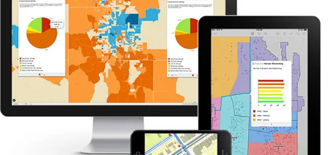
Explorer for ArcGIS Brings GIS to the Mac
Esri Releases First Native App for Apple OS X July 10, 2014, Redlands, California—Esri today released Explorer for ArcGIS on the Mac, a native OS X application to discover, view, and share maps.

Chinese Remote Sensing Drone Sets 30-hour Flying Record
A new Chinese unmanned aerial vehicle (UAV) set a new record for the country’s remote sensing drones by flying for more than 30 hours consecutively, the UAV’s developer, the Chinese

Non-Programmer’s Tutorial for Python 2.6
The Non-Programmer’s Tutorial For Python is a tutorial designed to be an introduction to the Phyton programming language. This guide is for someone with no programming experience.
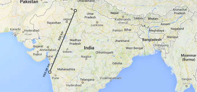
New Google Maps to Measure and Calculate Aerial Distances
The worlds most popular mapping platform, Google Maps now features measurement of aerial distances. To use the new tool, open Google Maps on your browser. Right click on the staring
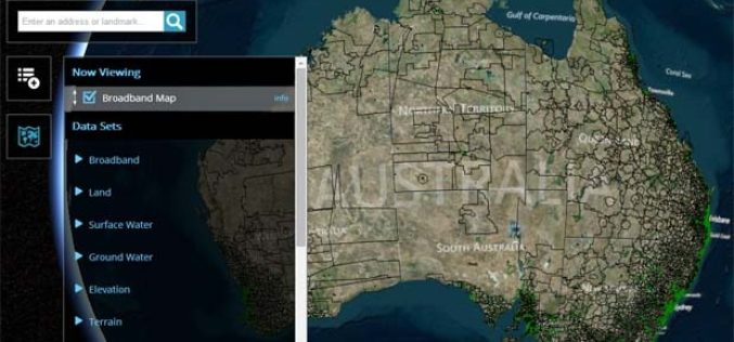
Australian Government Launches National Map Open Data Initiative
In recent news, Australian Government has launched a single platform for number of the data sets released by the government. With the launch of National Map Open Data Initiative, people

Spymesat Mobile App Now Offers High Resolution Satellite Imagery
Orbit Logic announced today that the iPhone version of their SpyMeSat mobile app will now offer in-app purchase of recent high resolution satellite imagery. SpyMeSat users will be able to use their
