
Posts From GIS Resources
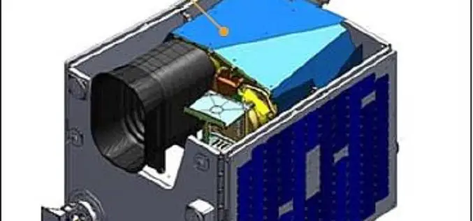
Kazakhstan’s EO Satellite KazEOSat-1 Launched Successfully
Kazakhstan first ever remote sensing or earth observation satellite, KazEOSat-1,was to launched from Kourou, The Space Centre of French Guinea on April 29, 2014. But was postponed due to weather

TerraGo Workgroups Brings the Power of GeoPDF® to Small Organizations and Teams
Company launches TerraGo Workgroups to bring GeoPDF collaboration capabilities to ArcGIS® customers with flexible, cost-effective subscriptions that meet their unique requirements. Washington, D.C. – April 28, 2014 – TerraGo announces the

Framework Contract for Supply of Satellite Remote Sensing Data, JRC, EC
Framework Contract for Supply of Satellite Remote Sensing Data, JRC, EC JRC/BRU/2012/H.6/0010/RC The purpose of this contract is to supply satellite data from the very latest sensors and products. The
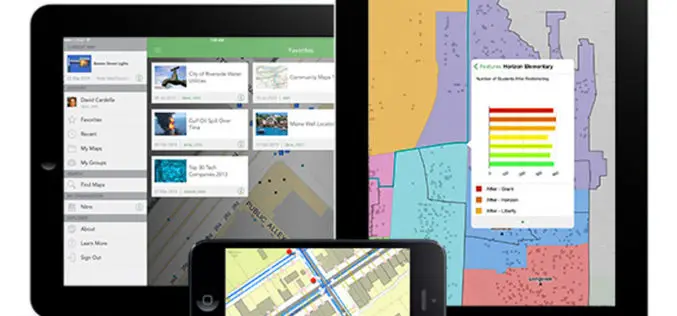
Explorer for ArcGIS Brings GIS to Everyone
Mobile App Simplifies Discovery, Visualization, and Sharing of Maps Redlands, California—Esri recently released the definitive GIS app for everyone to access and share maps on their smartphone and tablet. Called

SuperGIS Desktop Assists Geo-Sol, South Africa, in Efficient GIS Processing
Supergeo Technologies, a leading global provider of GIS software and solutions, announces that Geo-Sol, South Africa chooses SuperGIS Desktop 3.2 for high-efficiency GIS data processing and spatial analyses for earth
Android-Powered Mobile GIS, SuperSurv 3.1a, Supports Auto Positioning
Supergeo Technologies, a leading global provider of GIS software and solutions, announces that SuperSurv 3.1a for Android, the data collection app, now supports Auto Positioning to provide users with a
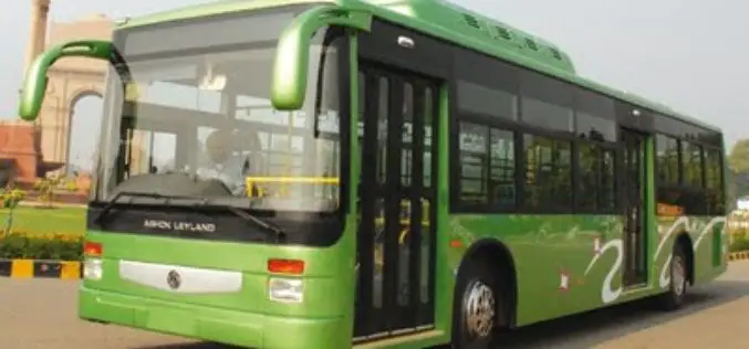
Many of DTC Buses Still Without GPS Devices
In recent news by Times of India, almost four years after the Delhi Transport Corporation (DTC) installed GPS in 3,000-odd buses, problems over the data and monitoring done by DIMTS
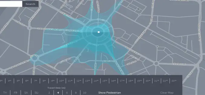
Isoscope a New Way to Explore and Visualize Mobility
We have been using Google Maps to find out the directions, distance and even real time navigation with estimated travel time according to traffic situations. But a team of developer in

DOST-UP’s Plane to Fly in ARMM to Chart Hazard Map
Manila, April 29 — The Department of Science and Technology (DOST) will fly a plane over the Autonomous Region of Muslim Mindanao in August to survey the region for hazard preparedness. The
PhD (Geoinformatics) – Bharati Vidyapeeth Deemed University, Pune
The Institute of Environment Education and Research, Bharati Vidyapeeth Deemed University (BVIEER) is unique educational and research institution. The distinctive characteri-stics of the BVIEER are its wide mandate of
