
Posts From GIS Resources
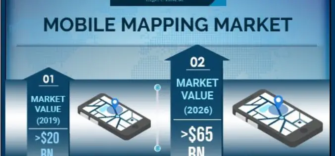
Mobile Mapping Market to Witness Steady Growth of 17% During 2020-2026
According to a recent study from market research firm Global Market Insights, the mobile mapping market is set to grow from its current market value of more than $20 billion

“MyGalileoDrone Competition 2020” Submission Open!
The European GNSS Agency (GSA), the operational agency of the European Commission for Galileo and EGNOS has launched its MyGalileoDrone competition on July 17. The increasing availability of Galileo–enabled
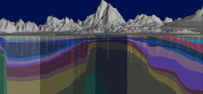
Seequent Accelerates Cloud-Based Solution to Help Keep World at Work on Major Projects
High-growth geoscience software company Seequent is accelerating the development of its cloud-based solution Seequent Central, enabling organisations to continue work on critical, large-scale, earth, environment and renewable energy projects in
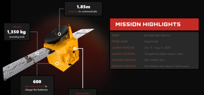
UAE Launches Mission to Mars – Emirates Mars Mission “Hope Probe”
The United Arab Emirates (UAE) Mars Mission “Hope Probe” to Mars is the first Arab Interplanetary Mission to provide a complete picture of the Martian atmosphere and its layers when it reaches the red planet’s orbit in 2021.
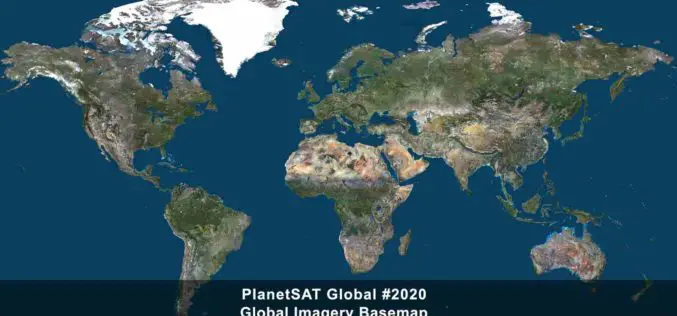
PlanetObserver Release of Updated Global Imagery Basemap
PlanetObserver geospatial data are perfect for numerous commercial, military and consumer applications, ranging from web-mapping to 2D and 3D visualization and simulation solutions, GIS tools, cartographic mapping to
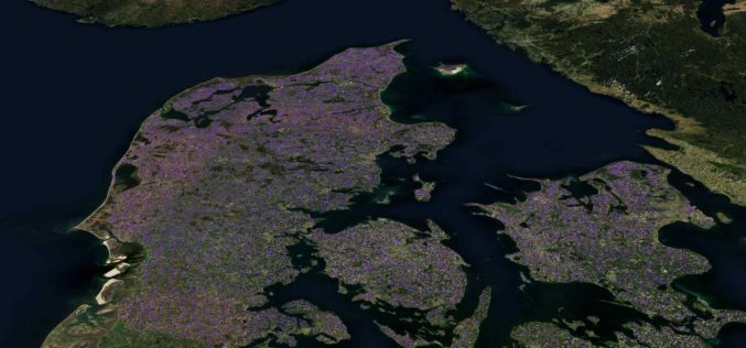
Machine Learning Helps SEGES to Detect 26K Slurry Tanks over Denmark to Assess Ammonia Emission
The article talks about How SEGES detected 26000 slurry tanks over Denmark in a few hours using Picterra to assess ammonia emission.
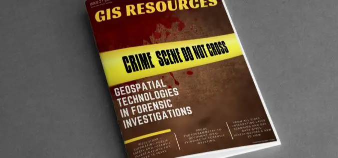
GIS Resources Magazine (Issue 2 | June 2020): Geospatial Technologies in Forensic Investigations
GIS Resources is pleased to announce the release of its 2nd edition (June 2020) of the print and digital magazine. The edition titled “Geospatial Technologies in Forensic Investigations” focuses on the
Get More from Imagery Using 30 New Features Released to Geomatica Banff
PCI Geomatics has announced the release of over 30 new features and enhancements to photogrammetry and remote sensing solution, Geomatica Banff.
Join MAXAR to Learn How Satellite Data is used by Organizations in Responding to Business Disruption and Emerging from Lockdown
Join MAXAR to Learn How Satellite Data is used by Organizations in Responding to Business Disruption and Emerging from Lockdown
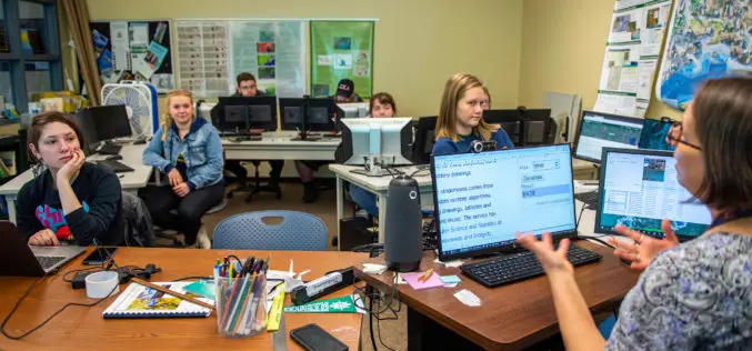
University of Maine at Machias to offer new Degree in Environmental Geographic Information Science
Machias, Maine — Beginning in fall 2020, the University of Maine at Machias will be the only public university in Maine to offer a four-year degree program in geographic information
