BRICS Space Agencies Signed Agreement for Cooperation in Remote Sensing Satellite Data Sharing
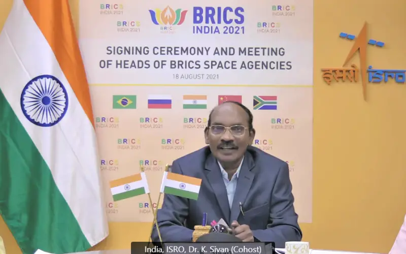
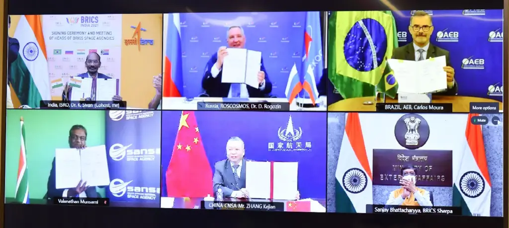
Under India’s BRICS Chairship, the BRICS Space Agencies Heads have signed an agreement for cooperation in remote sensing satellite data sharing on August 18, 2021, in the presence of Mr. Sanjay Bhattacharyya, Secretary (CPV&OIA) & India’s BRICS Sherpa, Ministry of External Affairs, Government of India and other officials from respective external/foreign affairs Ministries.
BRICS is the acronym coined to associate five major emerging economies: Brazil, Russia, India, China, and South Africa. Originally the first four were grouped as “BRIC” before the induction of South Africa in 2010.
Dr. K. Sivan, Chairman, Indian Space Research Organisation (ISRO)/ Secretary, Department of Space; Mr. Zhang Kejian, Administrator, China National Space Administration (CNSA); Dr. Val Munsami, Chief Executive Officer, South African National Space Agency (SANSA); Mr. Carlos Augusto Teixeira De Moura, President, Brazilian Space Agency (AEB); and Dr. Dmitry Rogozin, Director General, State Space Corporation “Roscosmos” have signed this Agreement.
This Agreement enables building a virtual constellation of specified remote sensing satellites of BRICS space agencies and their respective ground stations that will receive the data. This will contribute to strengthening multilateral cooperation among BRICS space agencies in meeting the challenges faced by mankind, such as global climate change, major disasters, and environmental protection.
* The news is reproduce based on information available on the ISRO website.
Also Read –
ISRO: Haze Removal Algorithm Developed for Cartosat Images