
Business

Esri Advances Scientific Analysis with SciPy
ArcGIS Programming Library Adds Power to Problem-Solving Redlands, California—Esri announces the integration of SciPy and ArcGIS. Scientists, engineers, and GIS professionals will use SciPy to get more value from ArcGIS

3D Laser Mapping Helps Preserve Earthquake Prone Buildings in New Zealand
New Zealand based Solutions By Zeal is reaping the rewards of using the ZEB1 hand held laser mapping system to survey buildings at risk from earthquakes or in need of
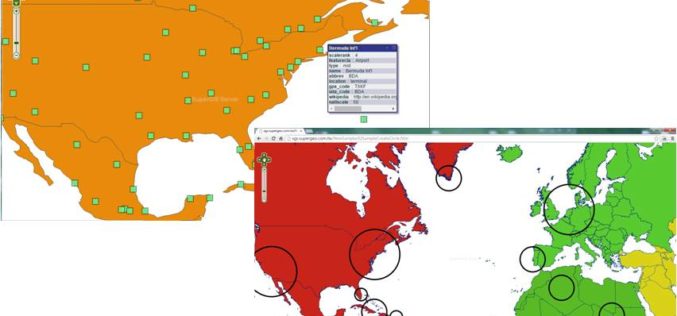
Various APIs in SuperGIS Server 3.2 Improve Customization Flexibility
Supergeo Technologies, the global leading GIS software and solution provider, releases rich JavaScript APIs (Application Programming Interface) to assist SuperGIS Server 3.2 users in customizing plentiful and intuitive map websites.

SuperGIS Supports Orienteering Club Charity Map Projects
Supergeo Technologies, the global leading GIS software and solution provider, announces that Star Vision Ltd., Supergeo Certified Reseller in Hong Kong, Macau and Guangdong, utilizes SuperGIS in a charity map

Meet 1Spatial At Europe’s Largest Smart Energy Event
Come and meet 1Spatial at European Utility Week 2014 running from 4th–6th November at RAI, Amsterdam, Netherlands Cambridge, 30 October 2014. 1Spatial plc, global specialists in Spatial Big Data management,

Onix Networking Now a Premier Partner with Centigon Solutions
Centigon’s CMaps Analytics Designer tool enables customers across many industries to enhance existing mapping tools LAKEWOOD, OHIO – October 30, 2014 – Onix Networking Corp. (“Onix”) today announced that it has earned

Blue Marble Creates New Global Mapper Academic Curriculum for GIS Educators
Blue Marble Geographics (bluemarblegeo.com) is pleased to announce the availability of Global Mapper Academic Curriculum, a series of academic labs that are offered at no cost to schools and colleges
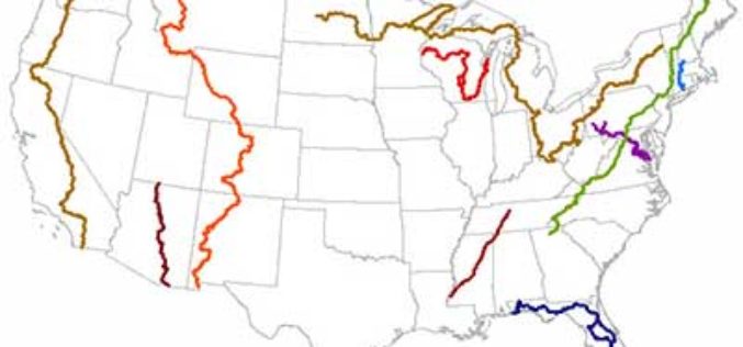
New Maine Maps Feature National Scenic Trails
Newly released US Topo maps for Maine now feature segments of the Appalachian National Scenic Trail (A.T.). Several of the 715 new US Topo quadrangles for the state now

Island University Receives Approval for Ph.D. in Geospatial Computing from Texas Higher Education Coordinating Board
October 24, 2014-AUSTIN, Texas, The Texas Higher Education Coordinating Board approved Thursday (Oct. 23) the creation of a Ph.D. program in geospatial computing at Texas A&M University-Corpus Christi. The first

StreetMapper First for Australia
Surveying company Whelans has purchased Australia’s first StreetMapper mobile laser scanning system from 3D Laser Mapping. Whelans purchased the system, which uses vehicle mounted lasers to capture highly
