
Remote Sensing

Vietnam to Use Remote Sensing in Agriculture
In recent news, Vietnam is gearing up to use Remote Sensing to boost its agricultural production. In a conference last week Le Quoc Doanh, Deputy Minister of Agriculture and Rural

Paragon Addresses Unique Transportation Needs of the Animal Feed Industry
July 31, 2014 – Paragon Software Systems, Inc., a leader in vehicle routing and scheduling optimization solutions, announces a unique transportation solution to target the specific needs of the animal feed industry.

Landsat and Water—Case Studies of the Uses and Benefits of Landsat Imagery in Water Resources
The Landsat program has been collecting and archiving moderate resolution earth imagery since 1972. The number of Landsat users and uses has increased exponentially since the enactment of a free
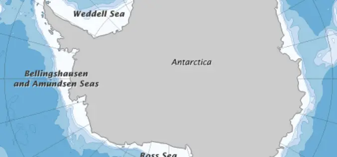
Error Discovered in Antarctic Sea-ice Record
Rising temperatures have caused the amount of Arctic sea ice to shrink dramatically since global observations began in the 1970s. But on the other side of the world, sea ice

Upcoming Changes to USGS ESPA Processing and Output options of Surface Reflectance Climate Data
Today I received an email from USGS as a notice of changes coming soon to the USGS EROS Science Processing Architecture (ESPA) interface (https://espa.cr.usgs.gov/) , that allows you to process Landsat 4/5 Thematic

Earth Station on Brazilian Land to get Data from IRS
In recent news, Prime Minister’s Office has informed that India and Brazil on Wednesday signed an agreement in Brasilia on cooperation in augmentation of a Brazilian earth station for receiving and

Free Climate Data for Germany of the Climate Data centre
The Deutscher Wetterdienst (DWD) makes available the whole collection of climate data it acquires, processes and archives. The CDC offers accesss to climate data for Germany, but also to data with

Chinese Remote Sensing Drone Sets 30-hour Flying Record
A new Chinese unmanned aerial vehicle (UAV) set a new record for the country’s remote sensing drones by flying for more than 30 hours consecutively, the UAV’s developer, the Chinese
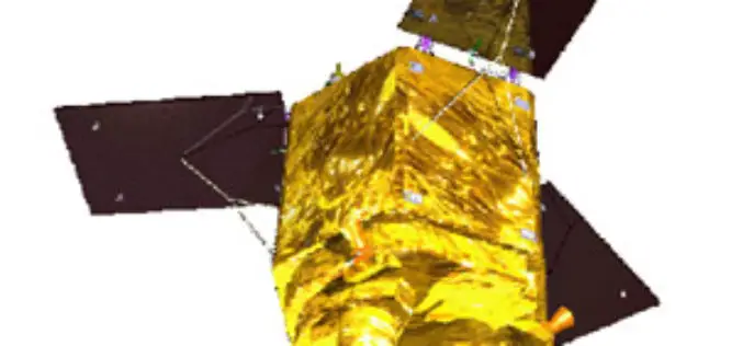
ISRO planning to launch French satellite SPOT 7 on June 26
ISRO is planning to launch its next rocket PSLV C23 carrying a French remote sensing satellite SPOT 7, along with four others from Sriharikota spaceport on June 26, a senior
Back to Back Three Satellite Launches by Iran Next Year
The Zafar, Tolou and AutSat are the three Iranian remote sensing satellites are line up to launch using Simorgh Launcher in the coming year (to start March 21, 2015). These
