
Remote Sensing
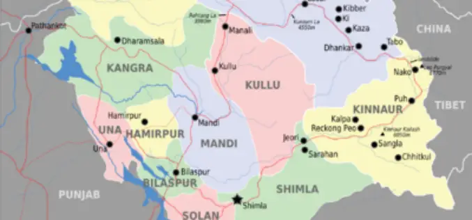
Glaciers and Lakes Mapping in Himachal Pradesh
In recent new, Scientists are mapping the glaciers and lakes in Himachal Pradesh keeping in mind the climate vulnerability and hazards. State Centre for Climate Change will map all glaciers
Pakistan Gets First Remote Sensing Lab
In recent news Dawn, Pakistan gets first remote sensing lab at Hyderabad established in collaboration with the Pakistan Space and Upper Atmosphere Research Commission (Suparco) and the Food and Agriculture
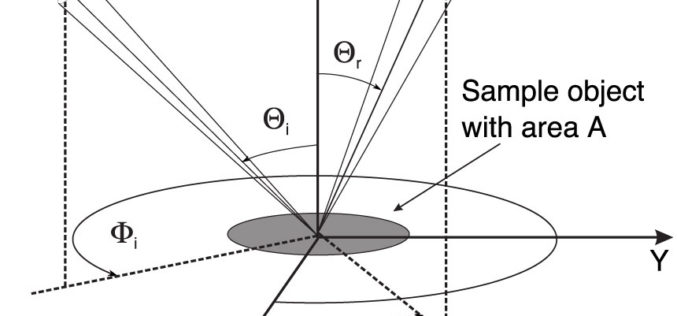
Monostatic Measurement of the Polarized Bidirectional Reflection Distribution Function
Monostatic Measurement of the Polarized Bidirectional Reflection Distribution Function by Oscar G. Rodríguez-Herrera and J. Scott Tyo Controlling the spatial coherence and polarization of electromagnetic waves sheds new light on the
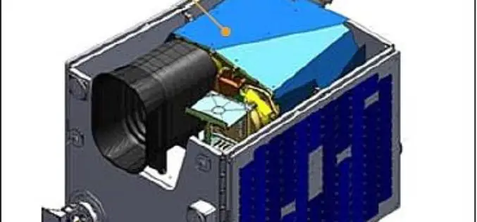
Kazakhstan’s EO Satellite KazEOSat-1 Launched Successfully
Kazakhstan first ever remote sensing or earth observation satellite, KazEOSat-1,was to launched from Kourou, The Space Centre of French Guinea on April 29, 2014. But was postponed due to weather

Tool for Remote Sensing Biomass Measurement
Terra Global Capital has developed a Tool for Remote Sensing Biomass Measurement. The Remote Sensing Biomass Measurement tool provides a method for determining Above Ground Live Tree Biomass (ALFB) through a
Kazakhstan to Launch its First EO Satellite on April 29
Kazakhstan first ever remote sensing or earth observation satellite, KazEOSat-1, is to be launched from Kourou, The Space Centre of French Guinea on April 29, 2014. The satellite system comprises
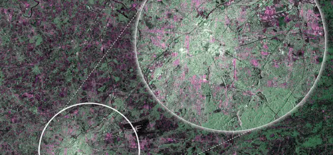
First RADAR Images of Earth by Sentinel-1A Satellite
ESA’s Sentinel-1A, kicked off on April 3, 2014, has delivered its first RADAR images of earth. ESA’s Sentinel-1A satellite will provide the ability of policymakers and service providers to access
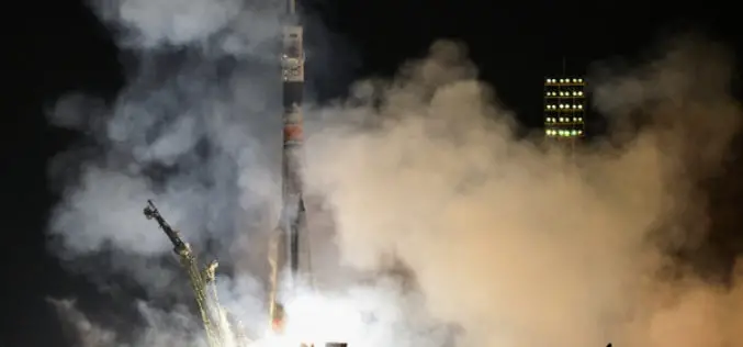
Egyptian Satellite Lift off Successfully from Baikonur
An Egyptian earth observation satellite, Egyptsat was successfuly launched from Baikonur cosmodrone on April 16, 2014. The satellite was on-board to Soyuz-U launch vehicle. Egypsat is equiped with advanced technologies for
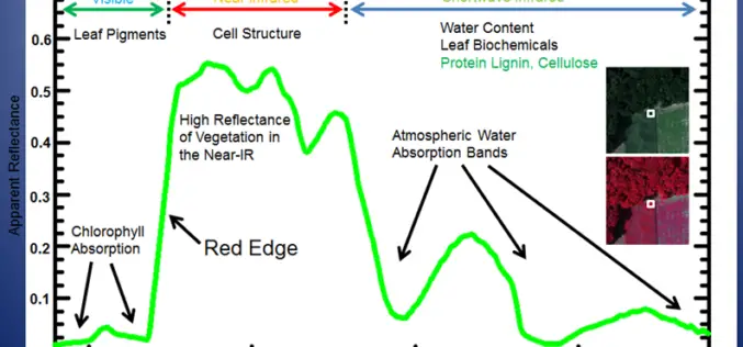
Why does NDVI, NDBI, NDWI Ranges From -1 to 1?
The indices calculated from satellite imageries such as the Normalized Difference Vegetation Index (NDVI), Normalized Difference Built Index (NDBI) and Normalized Difference Water Index (NDWI) have indices values ranging from
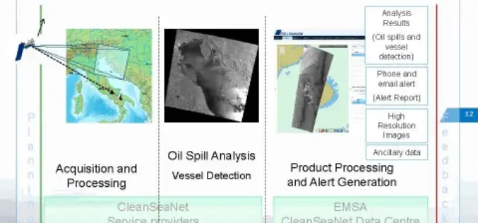
CleanSeaNet:Near Real Time Service to Protect Sea
In a wake to protect our sea, to safeguard marine habitat, serious risks of ecological damage and socio-economic losses, the European Maritime Safety Agency (EMSA) has started a satellite-based pan-European oil spill and
