
Software

Chennai Metro Rail in Southern India Selects Trimble Rail Solutions for Remote Diagnostics, Condition Monitoring and Analytics
SUNNYVALE, Calif., July 17, 2018 — Trimble (NASDAQ: TRMB) announced today that Chennai Metro Rail Ltd. (CMRL), operated by the Tamil Nadu State Government and the Government of India, will
Virtual Surveyor Streamlines Workflow, Enhances User Experience with New Version of Drone Surveying Software
LEUVEN, Belgium, 10 July 2018 – The Virtual Surveyor drone surveying software now offers a faster, more efficient workflow and better overall user experience in a more stable platform. These
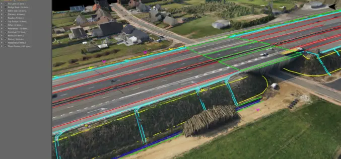
Novara GeoSolutions Unveils New Geospatial Product in Oil & Gas Industry
Norwell, MA – July 2, 2018 – Novara GeoSolutions (Novara) (www.novarageo.com), the industry’s leader in geospatial software and services for pipeline assets, announces the launch of a new product that is intuitive and

Voxxlr 1.0 Has Been Released!
March 06, 2018 – Voxxlr is a cloud based service to store, analyze and share large 3D point clouds entirely online. After years of development, version 1.0 has now been released. A

Global Mapper and LiDAR Module SDK v19.1 Now Available with New 3D Mesh Generation Capabilities
Hallowell, Maine – March 20, 2018 – Blue Marble Geographics (bluemarblegeo.com) is pleased to announce the immediate availability of version 19.1 of the Global Mapper Software Development Kit (SDK) along with
Orbit GT Releases 3D Mapping Feature Extraction Pro V18.0.6
March 19, 2018 – “We’re proud to announce that, with this release, our full portfolio has now been upgraded to version 18”, says Peter Bonne, CEO of Orbit GT. “As

Global Mapper v19.1 Now Available
Global Mapper v19.1 Now Available with 3D Profile Line Exporting, Multivariate Querying, and Expanded Drag-and-Drop Window Docking Blue Marble Geographics is pleased to announce the release of Global Mapper version
Orbit GT Releases 3D Mapping Content Manager V18
Jan. 30, 2018 – Orbit GT is happy to release the new 3D Mapping Content Manager v18. “The Content Manager is arguably the most unique yet extremely powerful product in our
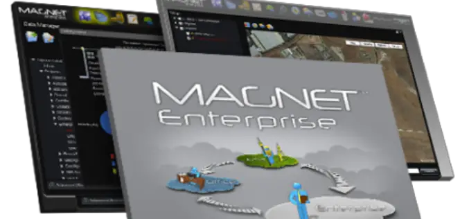
Topcon Announces Upcoming MAGNET Enterprise Release Including Autodesk BIM 360 Integration
Livermore, Calif., U.S – January 23, 2018 – Topcon Positioning Group announces an update to its MAGNET® Enterprise software system that will expand integration with Autodesk solutions with a new Autodesk BIM
GeoCalc SDK 7.4 Update Includes Support for New Projections and JSON Wrapper Classes for Calling to GeoCalc Cloud
Hallowell, Maine – January 23, 2018 – Blue Marble Geographics (bluemarblegeo.com) is pleased to announce the immediate availability of version 7.4 of the GeoCalc Software Development Kit (SDK). This powerful toolkit
