National Geospatial-Intelligence Agency Provides Expertise Response to West Virginia Flooding
As reported in a recent news bulletin by The National Geospatial-Intelligence Agency (NGA), NGA is providing geospatial expertise and damage assessments to the Federal Emergency Management Agency (FEMA) for flooded areas in West Virginia.
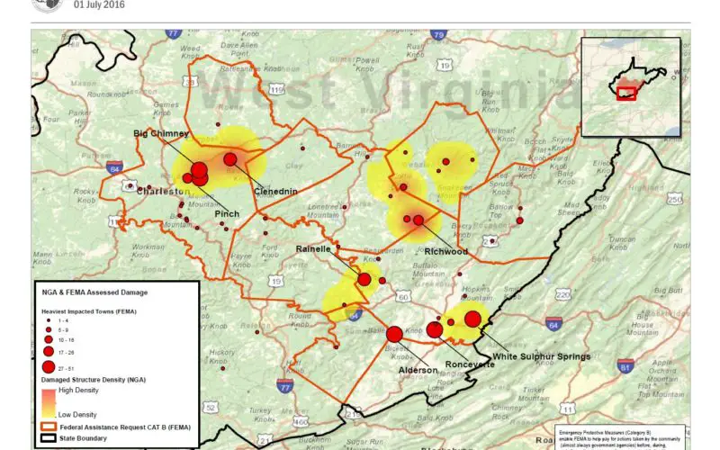
NGA is providing first responders with geospatial data, highlighting severe flooding areas. As of July 1, NGA identified floodplains in 10 populated areas in the counties of Greenbrier, Fayette, Webster, Kanawha and Nicholas, and supplied FEMA with indications of 570 damaged structures, eight impassable roads, and two damaged bridges. This allows response officials to more efficiently navigate affected areas to provide recovery assistance to West Virginia residents.
“NGA enables FEMA, state and local emergency responders to efficiently respond and assist American citizens during the readiness, response and recovery phases of natural disasters,” said Brian Cameron, NGA disaster analysis, and domestic support branch team lead and FEMA liaison. “The damage assessments that NGA provides helps first responders determine valuable personnel and resources for specific affected areas in a timely, responsive manner.”
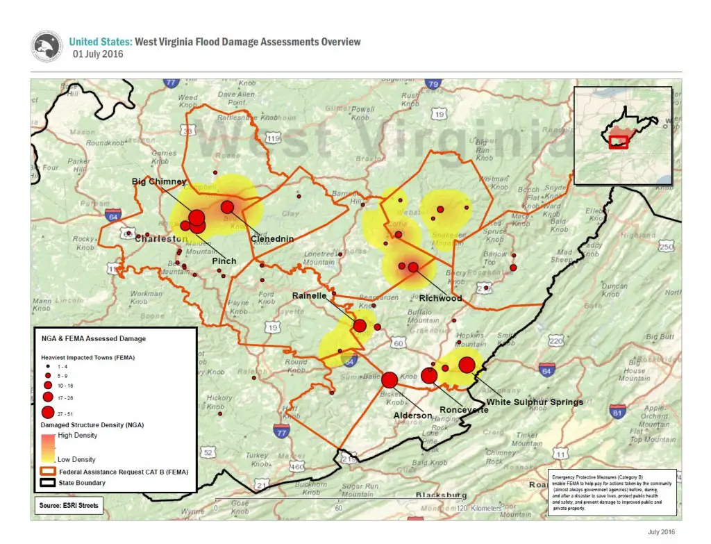
West Virginia damage assessment. Credit: NGA
Through FEMA, NGA is providing visualization products and web services that provide location and damage-specific information to county emergency officials, local law enforcement, urban search and rescue teams and the Rhode Island National Guard.
“We’re coordinating daily with FEMA and regional emergency officials to adjust commercial satellite collection over affected areas,” said Cameron.
One of NGA’s core mission sets is providing accurate and timely geospatial intelligence to first responders in the wake of natural disasters. NGA supports humanitarian and disaster relief efforts by working directly with the lead federal agencies responding to fires, flood, earthquakes, landslides, hurricanes or other natural or manmade disasters.