nowCOAST – a Web Mapping Portal to Real-Time Coastal Observations, Forecasts, and Warnings
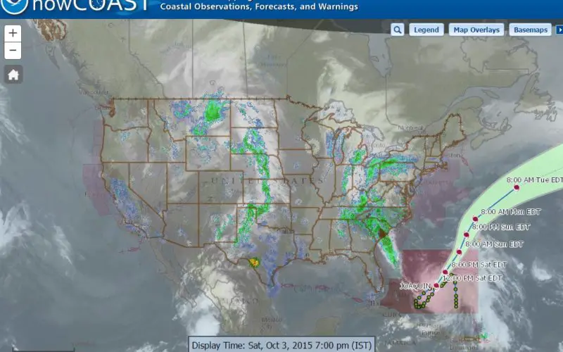
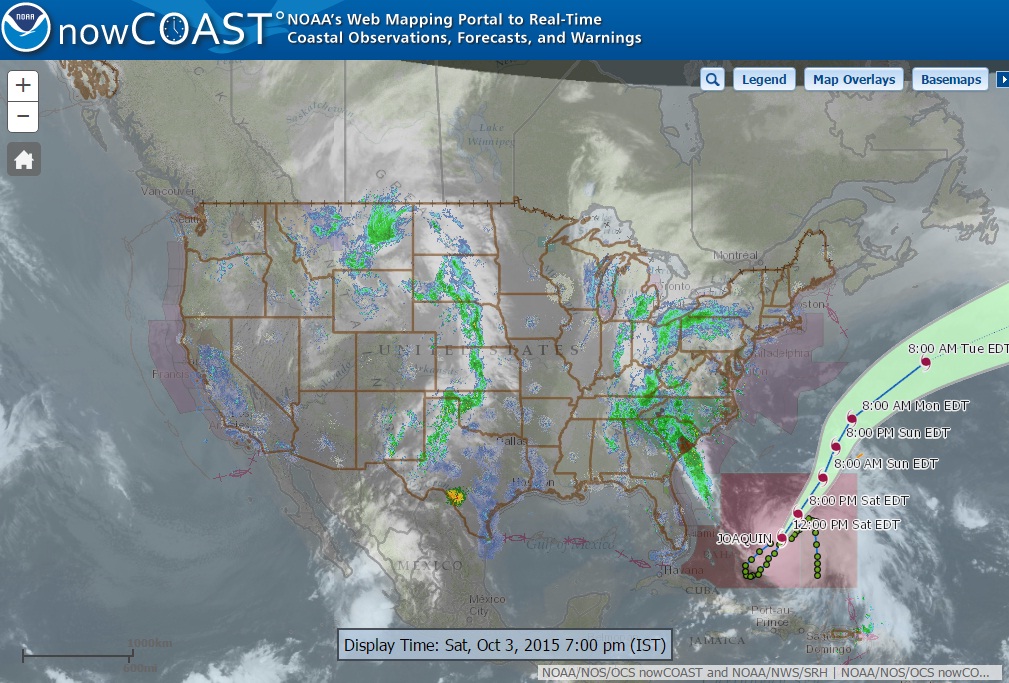
With Hurricane Joaquin approaching the eastern coast of the United States, anyone looking for reliable NOAA weather mapping services can use the recently launched updated version of NOAA/National Ocean Service’s nowCOAST, a GIS-based web mapping portal. nowCOAST has provided the coastal community for the past 12 years with a centralized site to display and obtain maps of near-real-time oceanographic and weather observations, analyses, imagery, model forecast guidance, forecasts, and warnings as well as hyperlinks to thousands of observing sites, point forecasts and forecast discussions from across NOAA.
Credit: NOAA
nowCOAST has been migrated to use newer web mapping software and an open source database. The new nowCOAST version provides users with both time-enabled ArcGIS Server Representative State Transfer (REST) map services and time-enabled OGC Web Map Services (WMS). nowCOAST’s new map viewer utilizes the time-enabled REST services, allowing users to display and animate observational data for the past few hours and forecasts and model guidance for several days into the future. Also, a few new map layers (e.g. forecast guidance from additional NOS oceanographic forecast modeling systems, near-real-time lightning strike density) have been added or expanded in temporal resolution and/or time extent in response to users’ requests over the years.
nowCOAST offers over 60 mapping services that can be accessed at http://nowcoast.noaa.gov/help/#!section=mapservices
In addition, the new nowCOAST has been moved into the NWS Integrated Dissemination Program (IDP) 24 x 7 high availability GIS hosting facility, operated by NWS/NCEP Central Operations. This will provide operational high reliability of nowCOAST ‘s map services and map viewer for its users and partners.
Visit nowCOAST at http://nowcoast.noaa.gov/
- FGDC