Satellite Reveals Decline in the Number of Forest Fires in Uttarakhand
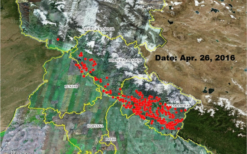
According to recent news by The Hindu, Satellite images show that there’s been a decline in the number of forest fires in Uttarakhand since April 28. Though fires in the region are still intense, images that have been sourced from two U.S. satellites Aqua and Terra and available on ISRO’s Bhuvan platform show an uptick between April 27-April 29 and then a fall, a fact that’s also been confirmed by ground reports from Uttarakhand.
An official at ISRO’s National Remote Sensing Agency in Hyderabad said that they hadn’t updated the latest figures for May 1 but confirmed that fire reports, reflected on the satellite maps, were a combination of the satellite as well as ground reports.
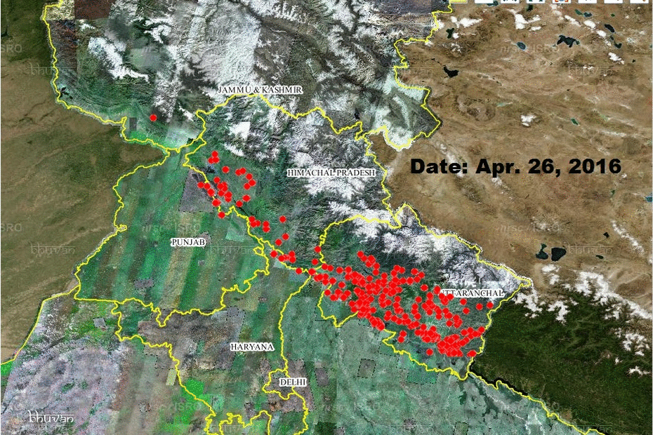
Red circles indicate active fire locations .
Visitors to ISRO’s website can view daily updates of the fires. Red circles indicate active fire locations and they are a composite of how the two satellites detect changes in heat on the land. Nearly 36 different wavelengths are analysed by these satellites for them to specify the locations of probable fires, said P.K. Joshi, a satellite imagery specialist and professor at the Jawaharlal Nehru University.