
Tag "DEM"
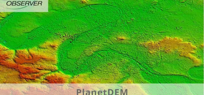
PlanetDEM – A Highly Reliable Digital Elevation Model
PlanetObserver has released PlanetDEM, its new global Digital Elevation Model (DEM) with a 30m and a 90m resolution. This new DEM offers an updated, reliable, and homogeneous 3D dataset of
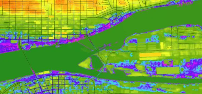
Highlight the Risk in Real Estate with Digital Elevation Model Data | cloudeo
Contributed by: Gokulakrishnan Balaji Student Marketing Munich +49 89 4141 786 23 gbalaji@cloudeo.group Location of new real estate comes with inherent uncertainties: what environmental hazards could affect this site? Before
Create Photogrammetric Point Cloud Using Global Mapper Pixels-to-Points Tool
Global Mapper LiDAR Module v.19 Now Available with Pixels-to-Points™ Tool for Photogrammetric Point Cloud Creation November 29, 2017 – Blue Marble Geographics is pleased to announce the release of version 19 of the
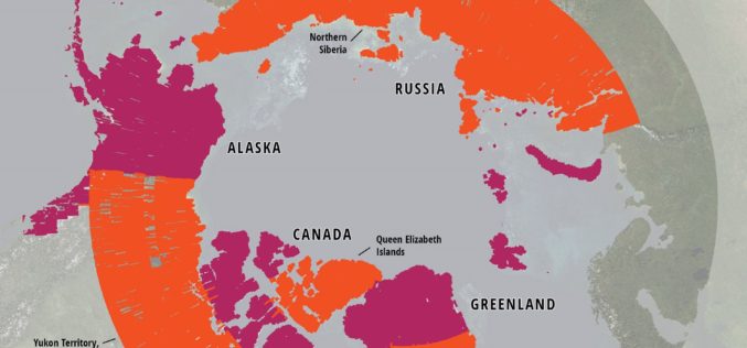
ArcticDEM Project Has Now Mapped More Than 65 Percent of The Arctic
ArcticDEM Release 5 represents the largest release of elevation data to date, more than doubling the number of available strip DEMs, mosaic tiles and geographic coverage area of all releases
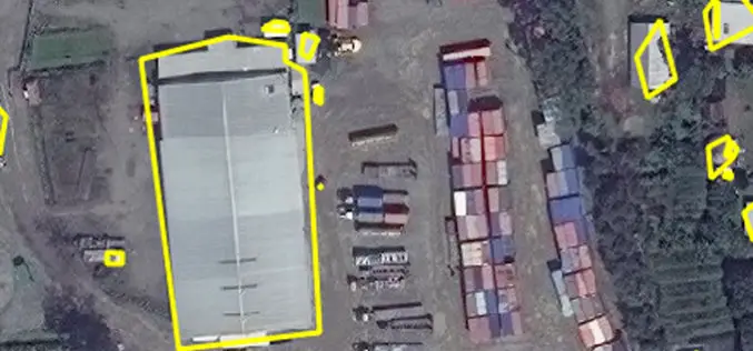
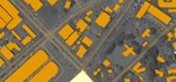
East View Geospatial Enhances Training Data Accuracy for Automated Feature Identification in Machine Learning Trials
MINNETONKA, Minnesota, USA, 1 June 2017 – East View Geospatial (EVG), a provider of content-rich cartographic products, continues to enhance the accuracy of automated feature identification using its newly developed

Airbus and CSTARS Provide “WorldDEM Ocean Shoreline” for Uniquely Accurate Coastline Mapping
Homogeneous, gap-free and single source vector product delineates world’s ocean shorelines detailed and up-to-date Friedrichshafen, 29 May 2017 – Airbus Defence and Space expands its WorldDEM portfolio with the launch

Icaros Releases Version 5.0 of OneButton™ Drone Image Processing Software
Icaros Releases Version 5.0 of OneButton™ Drone Image Processing Software Free 30-Day Trial FAIRFAX, Virginia, USA, 15 May 2017 – Icaros Inc., a leading provider of aerial imaging software, is pleased
East View Geospatial Announces Training Data Library for Geospatial Machine Learning
MINNETONKA, Minnesota, USA, 24 April 2017 – East View Geospatial (EVG), a provider of content-rich cartographic products, is building a library of highly accurate geospatial training data for use in
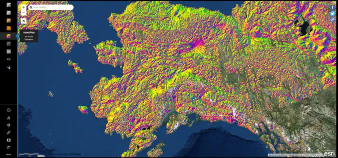
NGA Releases Biggest Collection of Arctic Elevation Data Yet at Esri FedGIS Conference
ArcticDEM Provides High-Quality Elevation Data and Enables Communities to Take Action Redlands, California—Esri, the global leader in spatial analytics, together with the ArcticDEM project—a public-private initiative to produce high-resolution, high-quality

PCI Geomatics Announces Collaboration with Deimos Imaging to Support the PanGeo Alliance
MARKHAM, Ontario, Canada—January 10, 2017: PCI Geomatics, a world-leading developer of remote sensing and photogrammetric software and systems, announced today it will be collaborating closely with Deimos Imaging to support
