
Tag "drones"

Tamil Nadu Pushes Agriculture Budget for Use of AI, Remote Sensing, and Drones
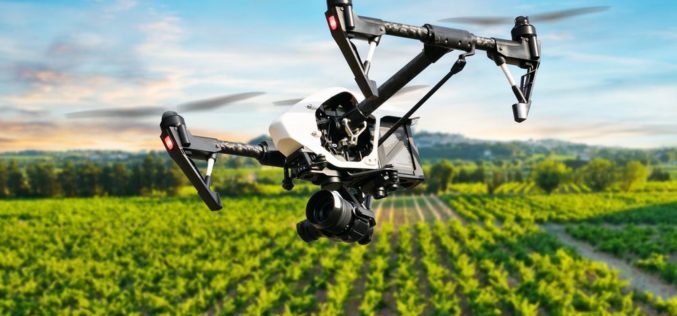
The Tamil Nadu (India) Agriculture State Budget for 2022-23 emphasizes the use of technology such as IoT, Artificial Intelligence, Drones, and Remote Sensing, as well as a role for industries
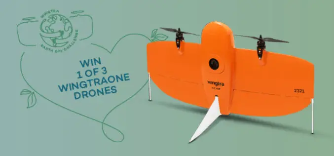
Give Away! 3 WingtraOne Drones for Projects that would contribute to the Good of the World
If you are someone inspired to complete a project that would contribute to the good of the world, here is your chance to win a WingtraOne GEN II drone. Wingtra

HERE and Unifly to Map the Airspace for Drones
Rich and accurate data sources will be vital for safe drone transportation In the Autonomous World, ground and airborne vehicle traffic will need coordination Las Vegas, CES – January 5, 2018
Government of India Issues Draft Norms For Using Drones
New Delhi, Nov 1 (PTI) – After long drawn discussions, the civil aviation ministry today unveiled draft norms for operating drones for civilian purposes in the country. The Unmanned Aerial

WiBotic Announces WiBotic PowerPad, the First Autonomous Wireless Charging Pad for Drones
New Wireless Charging Pad is Perfect for Mounting on Rooftops and Other Elevated Outdoor Structures; or Indoors for Drones Used in Factory or Inventory Management Seattle, WA—October 18, 2017—WiBotic, a
Skyfront Sets World Record for Drones with 4 Hour and 34 Minute Flight
Skyfront invents hybrid-electric drone technologies to enable monitoring of large, remote assets in challenging terrain for the Utility, Agriculture and Energy industries. MENLO PARK, CA, SEPT. 12, 2017 – Skyfront,

PDF3D V2.14 Release Meets Demands of Drones, Scanners and 3D Design Applications
PDF3D, leaders in 3D PDF conversion software, have today announced their new release and latest major update to the entire suite of products including PDF3D SDK, XML Server, ReportGen and
NASA Scientists Developed Technology to Help Drones Land Safely
PTI – WASHINGTON: NASA scientists have developed a new software that will help drones automatically spot the best places to crash-land in case of an emergency, without hurting anyone on
Centrik Collaborates with AviComply to Support RPAS Operators Across South Africa
Centrik, the management system for Remotely Piloted Aircraft Systems (RPAS) is set to dramatically simplify RPAS compliance and operational management in South Africa through a new strategic alliance with AviComply.

Swarms of Drones to Map Oil Spill
In a recent news released by the University of Buffalo, inspired by birds and insect behavior soon swarms of flying drones will be mapping oil spills. Souma Chowdhury, Assistant Professor, Department of
