
Tag "GEOINT"

NGA Solicits Input for Airborne SAR in Boosting Innovative GEOINT Topic Area
SPRINGFIELD, Va. – The National Geospatial-Intelligence Agency released the fifth topic of the agency’s Boosting Innovative GEOINT, or BIG, Broad Agency Announcement initiative, March 31, focused on airborne synthetic aperture
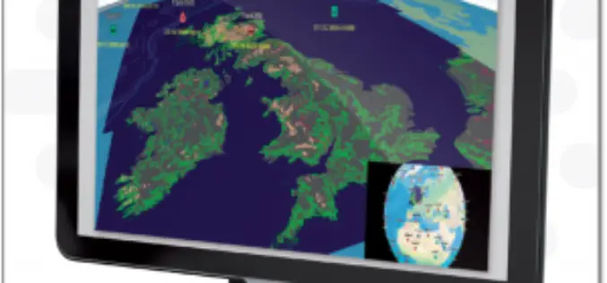
ENVITIA Launches MapLink Pro 10.0
ENVITIA is proud to announce the release of the next generation of MapLink Pro centered around the theme of speed. Speed in visualization of dynamic data, speed in the manipulation

Create, Share Geotagged, Media-rich Field Reports With New NGA Mobile App
The National Geospatial-Intelligence Agency’s latest publicly available mobile app is now available on iTunes and Google Play. The Mobile Awareness GEOINT Environment, MAGE, was developed to support first responders deploying
Esri Unveils Advanced Analytics at GEOINT
Demonstrations, Live Training, and Hackathon Winners Show the Power of GIS Redlands, California—Esri, the world leader in geographic information system (GIS) solutions, announced that it will be exhibiting and providing
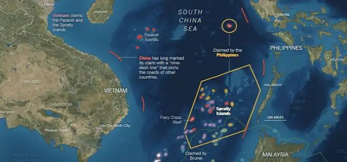
What’s Drives China in the South China Sea? A GEOINT View
Contributed By: The Spratly Islands are a group of more than 750 reefs, islets, atolls, cays and islands in the South China Sea. The history of territorial claim on these

USGIF Scholarship Program Now Open
The USGIF Scholarship Program and the Ken Miller Scholarship for Advanced Remote Sensing are now open and accepting applications. The USGIF Scholarship Program annually awards doctoral, graduate, undergraduate, and graduating

2015 USGIF Scholarship Program
USGIF’s purpose is to promote the geospatial intelligence tradecraft and to develop a stronger community of interest between government, industry, academia, professional organizations and individuals who share a mission focused

GIS to Provide Edge to Australia’s Military
A regional geospatial defence expert has urged the Australian Defence Force (ADF) to exploit the capabilities of Geographic Information System (GIS) technology to deliver greater operational and battlefield advantages to
Esri Geospatial Technology Speeds Analysis for US Army
Ready-to-Use Templates Quickly Deliver Critical Information to the Field April 7, 2014-Redlands, California—Esri has provided a recently revised set of customized templates to the US Army for its Distributed Common Ground
