
Tag "geospatial"
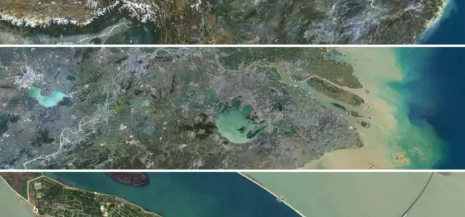
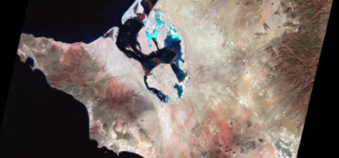
Release of PlanetSAT 15 L8 imagery Basemap of Asia by PlanetObserver
Clermont-Ferrand, 12 October 2016 – The French company PlanetObserver, specialized in imagery basemap production for more than 25 years, announced today the coverage of Asia with PlanetSAT 15 L8 basemap,

Boost Fieldwork Productivity with Latest SuperSurv 3.3
Supergeo Technologies Inc. has recently improved and released the latest version of SuperSurv, the leading mobile GIS software. Developed and maintained by the product team for years, SuperSurv is one

Trimble Sells its Unmanned Aircraft System Business to Delair-Tech
Strategic Alliances with Delair-Tech and Microdrones Expand UAS Platform Options While Leveraging Trimble Software and Data Solutions SUNNYVALE, Calif., Oct. 10, 2016—Trimble (NASDAQ: TRMB) announced today that Delair-Tech has acquired its

Trimble Changes Name to Reflect Company’s Technology Evolution
Completes Delaware Reincorporation SUNNYVALE, Calif., Oct. 3, 2016 Trimble (NASDAQ: TRMB) announced today that is has formally changed its company name from Trimble Navigation Limited to Trimble Inc. In addition,
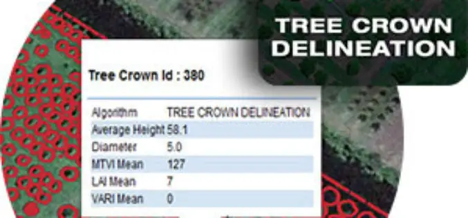
Tree Crown Delineation a New App to Monitor Trees
The latest drone app, Tree Crown Delineation automatically identifies individual tree crowns in your aerial survey. It also generates a geospatial layer of tree crowns with overall health level and

Esri Becomes Ambassador of NOAA and NWS Weather-Ready Nation
GIS Role in NOAA Weather Data Portal Key to Designation Redlands, California—Esri, the world leader in geographic information system (GIS) technology, today (September 27, 2016) announced its participation in the
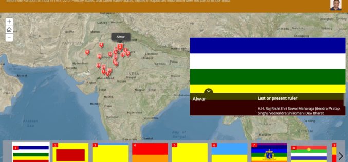
History of Princely States of Rajasthan through Story Map
Contributed By: Before the Partition of India in 1947, there was 562 Princely States existed in the Indian subcontinent which had not been conquered or annexed by the British but was subject
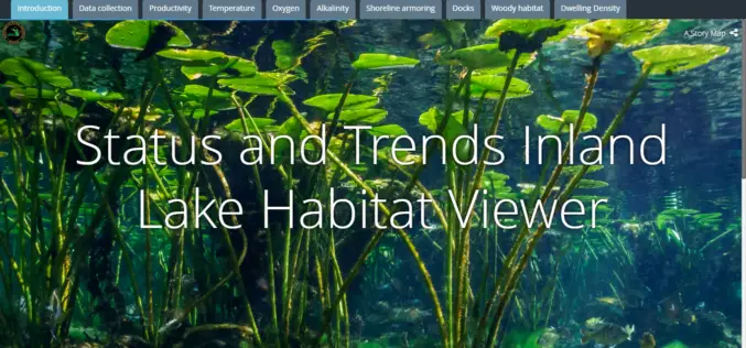
Michigan Department of Natural Resources Launches New Web-based Mapping Tool
The Michigan Department of Natural Resources has recently launched a new web-based mapping tool – the Inland Lake Habitat Viewer – to provide the public with information about the state’s inland lakes.
Earth on AWS: Large Geospatial Datasets Available on the Amazon Web Services
Amazon Web Services (AWS) had launched the Landsat on AWS in the year of 2015, a Public Dataset made up of imagery from the Landsat 8 satellite. On September 16, 2016 (AWS Blog),
What Transforms the Digital City into the Smart City?
Public participation makes the digital city truly smart Hamburg, Darmstadt 16 September 2016 | Involving the public is transforming the digital city into the smart city of the future. With
