Tag "geospatial"
Global Mapper Version 16.2 Now Available with Improved 3D Viewer, Upgraded Fly-Through Video Playback, and Numerous New Formats
Hallowell, Maine – May 19, 2015 – Blue Marble Geographics (bluemarblegeo.com) is pleased to announce the availability of version 16.2 of Global Mapper. This interim release includes functional upgrades and
AAM Expands into India to Create AAM India
AAM officially announced its expansion into India in New Delhi on 18 May 2015. At a ceremony held in the city, AAM Group entered a partnership with Mr. Srinivasa Murthy
OGC Announces Water Data Summit
The Open Geospatial Consortium (OGC®) announces a Water Data Summit to be held at the UCAR/NCAR Center Green in Boulder, Colorado on June 3, 2015. This event is part of
GIM International Announces New Event: GIM International Summit
GIM International, the global print and media platform for geomatics, is excited to announce the inaugural GIM International Summit which it will be organising from 10-12 February 2016 in Amsterdam,
Google Maps Temporarily Shut Down Google Map Maker
Google has temporarily shut down the Google Map Maker service. Google Map Maker allows community to make edits to Google Maps. The reason the service was shut down because of
Webinar: New Features in Geomatica 2015
New Features in Geomatica 2015 Thursday, May 14 at 8am GMT and 2pm EDT Geomatica is a powerful geospatial image processing software suite used by professionals, researchers and students around
Trimble Partners with Industry Leading Multirotor Unmanned Aircraft System Manufacturer
New Geospatial and Agriculture Workflows and Deliverables through Additional Aerial Imaging Solutions ATLANTA, May 5, 2015—Trimble (NASDAQ: TRMB) announced today that it is partnering with leading unmanned aircraft system (UAS)
Trimble Expands Storage Tank Inspection and Pipeline Measurement Portfolio for Geospatial Professionals in Oil and Gas
New Integrated Scanning Technology for Storage Tanks and Pipeline Analysis and Modeling Solutions Enables Increased Productivity SUNNYVALE, Calif., April 23, 2015—Trimble (NASDAQ: TRMB) announced today an expanded geospatial portfolio that
PR: LAStools Toolbox for ERDAS IMAGINE 2014 Released
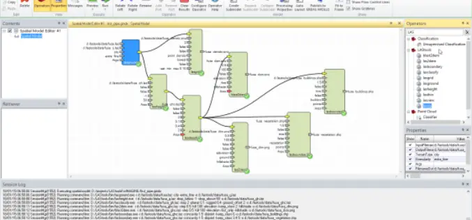
The latest release of LAStools from rapidlasso GmbH contains a new toolbox for ERDAS IMAGINE 2014, allowing the users of Hexagon Geospatial’s powerful remote sensing software to utilize the popular rapidlasso LiDAR processing modules. The tools
Introduction to GIS for Agriculture: Rangeland Focus Workshop
Introduction to GIS for Agriculture: Rangeland Focus Workshop Wednesday, April 15th, 2015, from 8:00am to 1:00pm Informatics and GIS Program (IGIS) by University of California aims to support research technology


