
Tag "geospatial"
DigitalGlobe Expands Partnership With Orbital Insight
Sep. 10, 2015 – Today we are excited to announce an expansion of our partnership with Orbital Insight, a geospatial analysis company that tracks socioeconomic trends at global, regional, and

Webinar on Transition of ENVI Analytics from Desktop to Web
Webinar on Transition of ENVI Analytics from Desktop to Web Tuesday, September 15, 2015 1:30 pm Singapore Time (Singapore, GMT+08:00) Geospatial imagery is used more and more across industries because

Geospatial Technology Helps Indian Air Force to Rediscover Lost Land
After a year of search with the help of satellite mapping and pain staking ground survey, a team of UP Board of Revenue and Indian Air Force (IAF) has been

Bridging the Gap between the Geospatial Sector and Society’s Global Challenges
Faced with such an abundant choice of trade shows, conferences and events, geospatial professionals often find it difficult to decide which ones to attend. The majority of those events are

Australian Government to Launch National Spatial Data Framework
According to the recent news in itnews, The Australian Government is planning to launch a national geospatial data framework by the next February. The move aims to cut millions of dollars

Proteus Announces Launch of Professional Satellite Image Procurement Service
Proteus, a provider of satellite derived mapping and geospatial services, announces the official launch of their new professional satellite image procurement service. Proteus employ dedicated expert account managers to provide
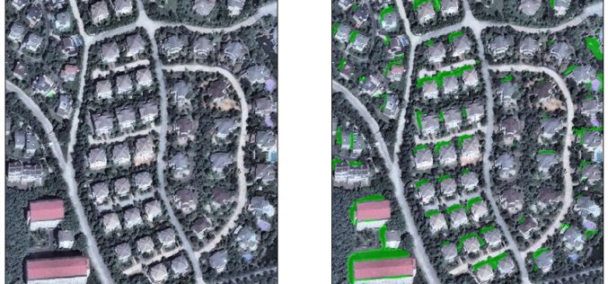
Hexagon Geospatial Visualizes Stories with the Hexagon Smart M.App
Hexagon Geospatial is pleased to introduce the Hexagon Smart M.App, providing a new way to understand and share your geospatial experience. These new light-weight applications cohesively combine data, workflows, and analytics.

Blue Marble Geographics Announces First Certified Trainer of Global Mapper
Blue Marble Geographics (bluemarblegeo.com) is pleased to announce that Engesat International S.A. of Brazil has successfully completed the training certification program. Together with his team, Laurent Martin, owner of Engesat
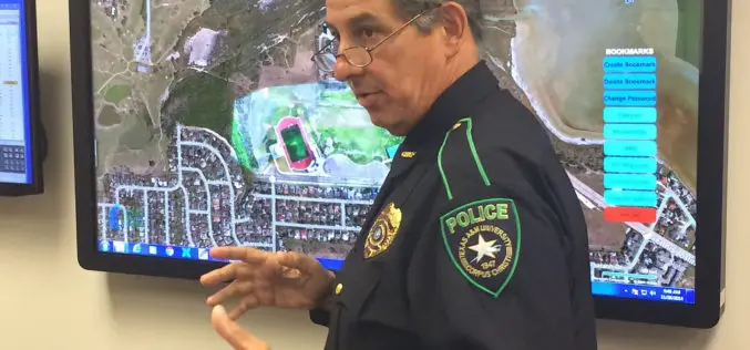
Mapping Application “SituMap”- Lets Emergency Responders See Scenes Virtually
CORPUS CHRISTI, Texas – A mapping application that lets first responders quickly and easily “see” an emergency situation with a digital command center is heading to the commercial market. The
UNESCO and UNITAR-UNOSAT Signed an Agreement to Protect Heritage Using Geospatial Technologies
UNESCO and UNITAR (the UN Institute for Training and Research) have signed an agreement to protect cultural and natural heritage sites with the latest geospatial technologies. It was signed at
