
Tag "GIS"
Global Mapper and Geographic Calculator Free Academic License Program is Now Live
Hallowell, Maine – May 2, 2017 – Blue Marble Geographics (www.bluemarblegeo.com) is pleased to announce the launch of its new academic licensing program with a new web page now available
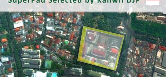
Taxation Authority in Indonesia Selects SuperPad 3.3 to Collect Data
With the assistance of Supergeo’s partner in Indonesia, DataScrip, the regional offices of Indonesian taxation authority recently selected SuperPad 3.3 as the mobile GIS software for spatial data collection. Under

SuperSurv Selected by Agricultural Company Socfinco
The global GIS software provider Supergeo Technologies Inc. is delighted to announce that its cutting-edge mobile GIS software SuperSurv has been chosen by Socfinco, the agricultural company. Located in Brussels,

TerraGo Edge 4.0 Re-Imagines the User Experience, Adds New Mobile Features and Expands ESRI® ArcGIS® Integration Options
Using a customer-driven, agile feedback loop, TerraGo Edge undergoes a complete redesign, improves every aspect of the user experience to help get work done faster, easier and more efficiently than

Uttar Pradesh: New Government Schools Only After GIS Mapping
Uttar Pradesh, India – According to recent news by The Hindustan Times, Uttar Pradesh will now get new government-run primary and upper primary schools only after completion of Geographic Information System
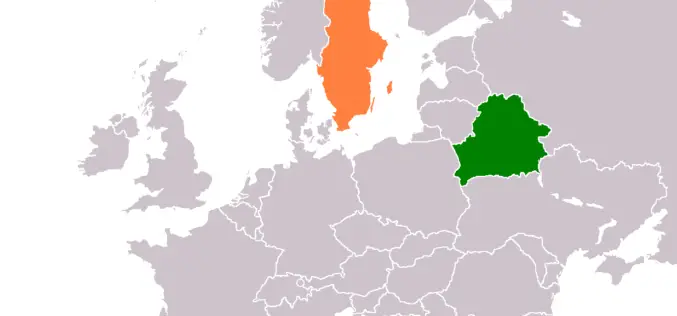
Belarus, Sweden to Share Experience in GIS Development
MINSK, 26 April (BelTA) – Belarus and Sweden will exchange experience in geographic information systems (GIS) development, BelTA learned from Belarus’ State Property Committee. A delegation of specialists of the
University of Guelph: Prof. John Lindsay Develops Whitebox Geospatial Analysis Tools for Processing Geospatial Data
Professor John Lindsay has developed a one-of-a-kind software package called Whitebox Geospatial Analysis Tools for processing geospatial data that he says has put the University of Guelph on the map
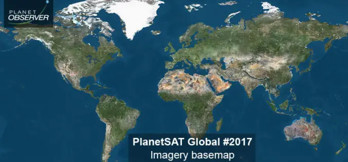
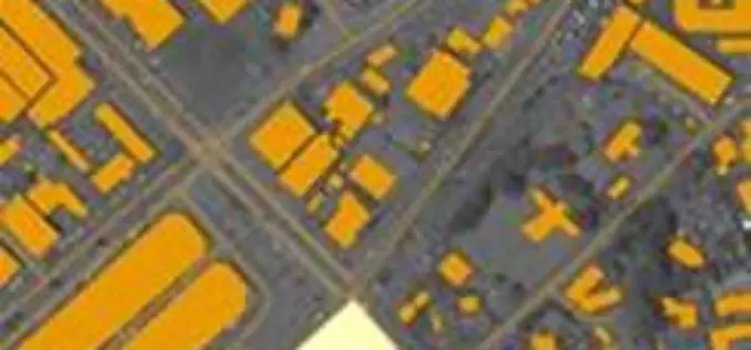
PlanetObserver Announces Release of PlanetSAT Global Imagery Basemap Version #2017
Clermont-Ferrand, France – 26 April 2017 – The French company PlanetObserver, supplier of geospatial data for all civil and military visualization and simulation applications, and GIS solutions, announces the release

Smart Cartography: “Six Examples of How Old-fashioned Navigation Aids Have Been Transformed into Today’s Smart Maps”
SMART CARTOGRAPHY: Six examples of how old-fashioned navigation aids have been transformed into today’s smart maps Berlin, Germany 25, April 2017 | The 65th Cartography Conference run by the German Society
East View Geospatial Announces Training Data Library for Geospatial Machine Learning
MINNETONKA, Minnesota, USA, 24 April 2017 – East View Geospatial (EVG), a provider of content-rich cartographic products, is building a library of highly accurate geospatial training data for use in
