
Tag "GIS"

SuperGeo Webinar: 3D GIS Cadastral Mapping
SuperGeo Webinar: 3D GIS Cadastral Mapping Wednesday, August 16, 2017 | 10:00 AM (GMT+2) Your local time In the past, landscapes in the real world must be transformed into 2D and then

User-defined Coordinate System Will Soon Be Available in SuperSurv 10
Data collection is always a crucial work before making decisions in almost every professional field. In geo-related fields, the ability to collect geospatial data quickly and accurately will significantly improve

Smart Map Bhopal: A City Level Web-Based GIS solution
Smart Map Bhopal is an enterprise-wide web-based GIS solution created using ArcGIS platform and seamlessly functions across various the web & mobile devices. GIS System will provide
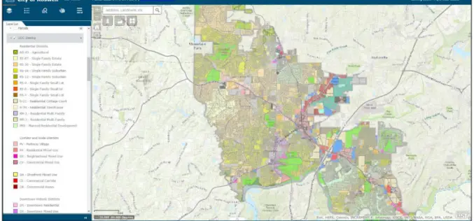
City of Roswell: A Case Study – Creating and Maintaining a GIS Enterprise
Introduction The bustling City of Roswellhas seen its population increase substantially over the course of the last twenty years, becoming the eighth largest city in the State of Georgia. Although

CompassDrone™ to Demo Integration of DJI Video with ArcGIS at Esri Mapping Forum
CENTENNIAL, Colorado, 29 June 2017 – Full motion video (FMV) captured by the best-selling drones in the world can now be viewed, queried and used for professional mapping projects in Esri ArcGIS.

ISRO Successfully Launches Cartosat-2 Series Satellite Along with 30 Co-passenger Satellites
Jun 23, 2017 – ISRO’s Polar Satellite Launch Vehicle PSLV-C38 successfully launched the 712 kg Cartosat-2 Series Satellite along with 30 co-passenger satellites today (June 23, 2017) from Satish Dhawan Space

A Smart City for Its Inhabitants with Sustainable Growth
The term “smart city” has become a familiar word during the past year or two. But as yet few really know what it envisages, how it is to
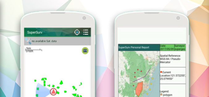
New Features of SuperSurv 10 that You Cannot Ignore
The global IT industry is skyrocketing today, and so does the development of geospatial industry, especially the progress of integrating GIS and GNSS technologies into mobile devices. Base on such

Ministry of Public Works of Indonesia Selects SuperSurv
With the assistance of Supergeo’s reseller in Indonesia- GPS Lands Indosolutions, the Ministry of Public Works and Housing (Kementerian PUPR) of Indonesia has selected SuperSurv for their tasks of spatial
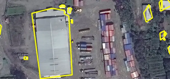
East View Geospatial Enhances Training Data Accuracy for Automated Feature Identification in Machine Learning Trials
MINNETONKA, Minnesota, USA, 1 June 2017 – East View Geospatial (EVG), a provider of content-rich cartographic products, continues to enhance the accuracy of automated feature identification using its newly developed
