
Tag "GIS"

Remote Sensing Centre to Zero-In On Water Sources in Maharashtra
March 05, 2013 – The Maharashtra Remote Sensing Application Centre will launch a web-based GIS of public drinking water sources in the state. The project will also involve creating a

Supergeo Expand Partnership with Géo.RM, France
Supergeo Technologies, the global leading GIS software and solution provider, announced the renewal of SuperGIS software contract with Géo. RM, France. The extended collaboration will continue bringing French-speaking users the
Independent Report Highlights Esri as Leader in Global GIS Market
Esri and Partners Lead GIS Deployment in More than 10 Industries, Including 28 Percent Share of Electric Transmission and Distribution Market Redlands, California—ARC Advisory Group reports that Esri has a
New Stable Version of GRASS GIS 7.0.0 is Released
After many years of development the new stable major release GRASS GIS 7.0.0 is available. The graphical user interface based on wxPython has been enriched with many new features in

Supergeo Renews Partnership with Star Vision for GIS Development in Southeast China
Supergeo Technologies, the global leading GIS software and solution provider, announced the extended partnership with Star Vision, the professional GIS consulting and surveying firm in Hong Kong, to further develop

New Esri Book Applies the Science of GIS to Literature, History, and Culture
Maps created using geographic information system (GIS) technology can be used to explore and interpret events in literature, history, and culture. That’s the premise of Abstract Machine: Humanities GIS, a
Intelligence In The Cloud
Lockheed Martin And Esri Cloud Deployment Enables Geospatial Information Sharing Across Intel Community Lockheed Martin [NYSE: LMT] and Esri have deployed commercial software to the Amazon Web Services Commercial Cloud

Webinar: TerraGo Edge v3.4 Adds Powerful GPS Features
TerraGo Edge v3.4 Adds Powerful GPS Features Tuesday, March 3, 2015 12:00 PM EST Join this webinar and get an overview of TerraGo Edge v3.4 new functions and capabilities. TerraGo
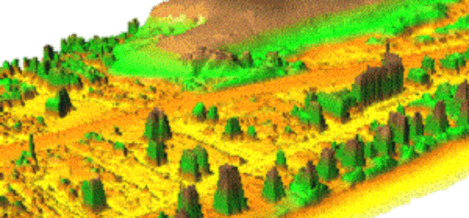
DAT/EM Summit Evolution Compatible with Blue Marble’s Global Mapper
The new Global Mapper Extension from DAT/EM Systems International connects Global Mapper from Blue Marble Geographics® with any edition (Professional, Feature Collection or Lite) of DAT/EM’s famous Summit Evolution™ stereoplotter.

Salisbury University Offering Master’s in GIS Management
Salisbury University is a premier comprehensive Maryland public university with four privately endowed schools, offering excellent, affordable education in undergraduate liberal arts, sciences, business, nursing, education and social work and
