
Tag "GIS"
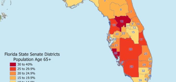
Maptitude 2018 USA Legislative and Congressional Districts
NEWTON, MASSACHUSETTS (USA) – Caliper is pleased to announce that the State Legislative Districts Data Product is now available for the entire USA or for a single US state. Three area databases

TatukGIS Releases GIS SDK for Java
Gdynia, Poland – TatukGIS now brings its nearly two decades of GIS technology expertise to the Java development platform. The new Developer Kernel for Java edition is a general-purpose GIS SDK
EuroGeographics Announces New Additions to Open Data for 2018
February 20, 2018 – EuroGeographics has released a new version of EuroGlobalMap, its open data created from official national sources. Forty-five members of the Association for the European National Mapping, Cadastral
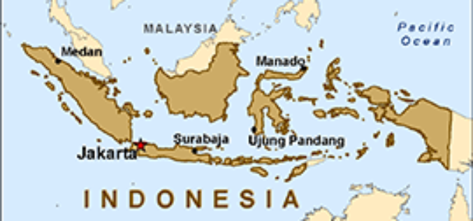
Indonesian Peat Prize Announces 1 Million US Dollar Competition Winner
Indonesian Peat Prize Announces 1 Million US Dollar Competition Winner: International Peat Mapping Team: Remote Sensing Solutions GmbH (RSS), Agency for Assessment and Application of Technology (BPPT), and Sriwijaya University
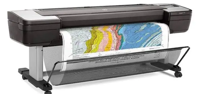
HP Launches World’s Most Secure Large Format Printers for GIS Mapping
Adds HP Secure Boot and Whitelisting to HP DesignJet T1700 printers for enterprise and government. Jan. 30, 2018 – HP Inc. introduced HP DesignJet T1700 printers, next-generation 44-inch solutions for CAD and geographic

Boundless Launches Massively Scalable Geospatial Server for the Enterprise
Boundless Server Enterprise Serves Location Data In The Cloud; Offers Most Powerful Solution for Availability and Responsiveness St. Louis, MO – Jan. 30, 2018 – Boundless, the leader in open GIS,
GeoCalc SDK 7.4 Update Includes Support for New Projections and JSON Wrapper Classes for Calling to GeoCalc Cloud
Hallowell, Maine – January 23, 2018 – Blue Marble Geographics (bluemarblegeo.com) is pleased to announce the immediate availability of version 7.4 of the GeoCalc Software Development Kit (SDK). This powerful toolkit
Esri Releases World’s First Complete Utility GIS Platform
New Utility Network Management Extension Combines Advanced System of Record with Location-Based Analytics Redlands, California – January 22, 2018 – Esri, the global leader in geographic information system (GIS) technology and spatial analytics,

thinkWhere Takes a Global View with theMapCloud Platform
Stirling, Scotland, January 17, 2018 – Scottish Geographic Information Systems (GIS) company thinkWhere is setting its sights on global expansion with the launch of a new cloud-based platform for GIS and
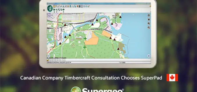
Canadian Company Timbercraft Consultation Chooses SuperPad
The global GIS software provider, Supergeo Technologies Inc., is excited to announce that the Canadian consulting firm Timbercraft Consultation Inc. selects SuperPad to record spatial data. Specialized in geographic data
