
Tag "GIS"
Making a Giant Leap Toward Smart Irrigation with SuperGIS
Geographic Information System (GIS) is becoming extremely popular nowadays for its capability of solving problems in the domains like cadastre management, network analysis, location selection, spatial statistics, etc. to name
Blue Marble Geographics Adds Chinese Reseller to its Worldwide Network of Partners
Hallowell, Maine – December 19, 2017 – Blue Marble Geographics (bluemarblegeo.com) is pleased to announce that Beijing E-Carto Technologies Co., Ltd. has joined the growing list of partner companies reselling and

Qatar to Develop 4D Mapping Technology to Boost Urban Planning and Other Applications
According to recent news by The Peninsula, the Center for Geographic Information Systems(CGIS) under the Ministry of Municipality and Environment is working on a cutting-edge technology to develop 4D mapping features
Esri Signs Global Enterprise Agreement with Airbus Defence and Space
New Agreement Gives Airbus Defence and Space Online Spatial Analytics for Faster, More Cost-Effective Operations November 30, 2017 – Redlands, California—Esri, the global leader in spatial analytics, today announced that it

Top 5 GIS Trends for 2018
Contributed By: You’re reading this because seamlessly integrating Geographical Information Systems (GIS) into your company’s IT infrastructure including SAP is crucial. Challenges you’re grappling with probably include absorbing tech upgrades

Presagis Introduces New Automated Virtual Environment Production Solution
November 27 2017 – Montreal, Canada – Presagis™, a recognized leader in modeling and simulation software, today introduced VELOCITY, a next-generation software solution that automates the production of large synthetic training
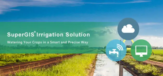
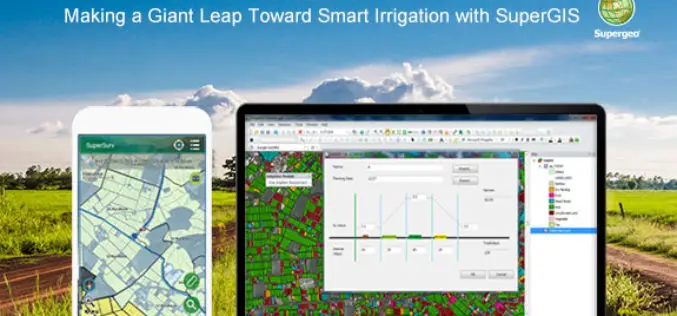
Supergeo Partners with Agricultural Engineering Research Center to Develop Irrigation Solution
Supergeo is excited to announce that Agricultural Engineering Research Center (AERC), the leading research institute in irrigation study, has collaborated with Supergeo to develop an irrigation solution based on SuperGIS
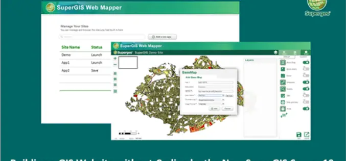
Building a Unique GIS Website without Coding by Brand New SuperGIS Server 10
Supergeo, the global leading GIS software provider, is glad to announce its brand-new GIS server software, SuperGIS Server 10, is expected to be launched in the mid-November! Inheriting the high

Global Mapper SDK Now Available on Amazon Web Services
Hallowell, Maine – November 16, 2017 – Blue Marble Geographics (bluemarblegeo.com) is pleased to announce that the Global Mapper Software Development Kit (SDK) has been expanded to provide data processing capabilities

Global Analysis and GIS Forecast in the Telecommunications Market in 2017-2023
Report “GIS in the telecommunications market by type (software and services), deployment models (cloud and local) and the end user (small and medium business and large enterprises); Global Opportunity Analysis
