
Tag "GPS"

Russia’s Glonass an alternative to the Brazilians for GPS
In recent news by Sputnik, the Russian Global Navigation Satellite System (Glonass) will provide Brazilians with an alternative to the American Global Positioning System (GPS), giving them more localized data and stability, the

SuperSurv 3.2 Supports iOS 8 and Enhances GPS Display
SuperSurv (iOS) 3.2, the field data collecting app for iPhone and iPad users, now fully supports iOS 8 and enhances GPS display with optimal user experiences. Developed by Supergeo, SuperSurv

Discover the Secret Life of Your Cat with the G-Paws GPS Pet Tracker
Ever wondered what your cat does when you’re not around? Wonder no more, because, following their success providing accurate mapping to BBC’s Cat Watch 2014, Ordnance Survey is now stocking G-Paws
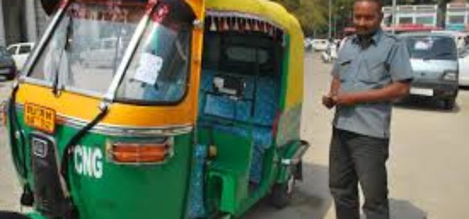
No Auto-rickshaw Without GPS to Ply on Delhi Roads
In view of passenger safety, the Delhi government has decided not to allow autorickshaws plying in Noida, Ghaziabad, Sonipat and Faridabad without GPS to enter into the national capital. The

ThinkGeo Releases Map Suite for Android, iOS and WebAPI
Frisco, TX — ThinkGeo is proud to announce the additions of Map Suite WebAPI , Map Suite for Android and iOS platforms to the Map Suite family of products. These

First GPS-Collar Study Reveals How Leopards Co-Exist With Humans in India
Washington: A new first-of-its-kind GPS-collar study has recently revealed how leopards in India live with people. The study concluded that leopards in human areas are not always “stray” or “conflict” animals
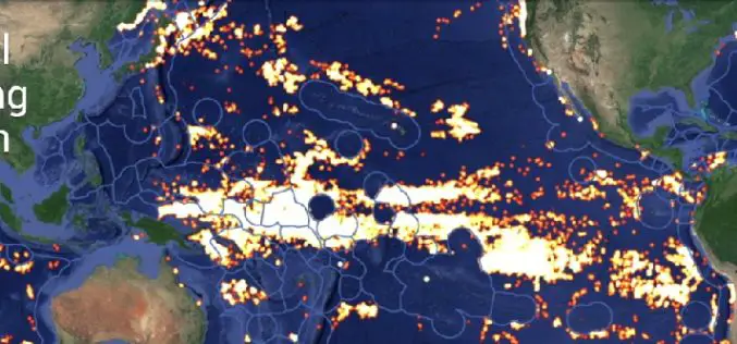
Global Fishing Watch Using Mapping Technology
Global Fishing Watch is the product of a technology partnership between SkyTruth, Oceana, and Google. Global Fishing Watch is a technology platform that uses satellite data to inform the public

Webinar: Using GPS with Global Mapper
Using GPS with Global Mapper November 20, 2014 at 11:00 am (EST) Over the last decade, GPS positioning technology has become increasingly ubiquitous. It is built into our cars, our
University of Kerala Announces Admission to PG Diploma in Geo-Information Science and Technology
UNIVERSITY OF KERALA Centre for Geo-Information Science and Technology (A centre of excellence supported by the DST and KSCSTE) Announces admission to the PG
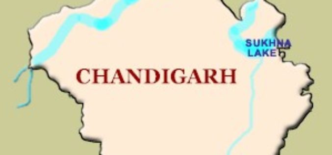
GPS to Map Accident-Prone Areas in Chandigarh
In recent news, Chandigarh traffic police has planned GPS mapping of the entire city. This maps will be created using Geographical Information System (GIS) and will be uploaded online and
