
Tag "Landsat Satellite"

Landsat 9 Satellite – Latest and Powerful Satellite in the Landsat Series
Landsat 9 carries two science instruments – the Operational Land Imager 2, and Thermal Infrared Sensor 2.

USGS Ups Ease of Use for Landsat Data
Landsat satellite data have been produced, archived, and distributed by the U.S. Geological Survey since 1972. Data users in many different fields depend on this basic Earth observation information to

Download Free Landsat 8 Imagery from the Amazon Web Services Cloud
Amazon has announced the availability of Landsat on Amazon Web Services. Under this program, Amazon will host 1 petabyte of Landsat imagery from USGS on the Amazon Web Services Cloud. You
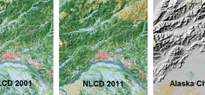
A Decade of Change in America’s Arctic: New Land Cover Data Released for Alaska
The latest edition of the National Land Cover Dataset (NLCD 2011) for Alaska is now publicly available. The extensive NLCD database continues to add to our understanding of where land

How to Download Landsat Satellite Data?
In this exercise you will learn, how to download Landsat satellite data? The USGS Earth Resources Observation and Science (EROS) Center archive holds data collected by the Landsat suite of
