
Tag "mapping"
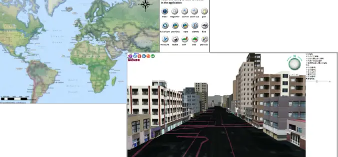
Mapping Application “SituMap”- Lets Emergency Responders See Scenes Virtually
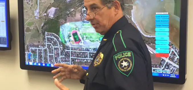
CORPUS CHRISTI, Texas – A mapping application that lets first responders quickly and easily “see” an emergency situation with a digital command center is heading to the commercial market. The
Amnesty International Launches Online Tool Mapping Exposing Israeli Attacks in Gaza
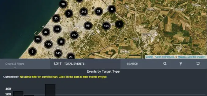
Amnesty International and Forensic Architecture has launched an investigative online tool mapping Israeli attacks in Gaza during the conflict of July and August 2014. The mapping tools aimed to push accountability

Geo-matching.com Updates Total Stations Category
Geo-matching.com has recently updated the specifications of the Total Stations product category. Topcon and Trimble are the first suppliers that have updated the specifications for some of their total stations.
Mobile Mapping App Helps Humanitarian Organizations Clear Landmines In War-Torn Countries
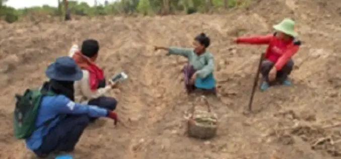
Spatial Networks, a St Petersburg, FL based technology firm, has discovered a new application for Fulcrum, its mobile mapping platform – helping humanitarian organizations like HALO Trust identify landmines in
Increase the Return on Your GIS Investment with GIS-Lite Applications
Increase the Return on Your GIS Investment with GIS-Lite Applications July 14, 2015 12:00-12:30 PM ET Deliver self-contained, interactive maps and lightweight GIS applications available to all end users with
Insights to SuperGIS Server 10
Supergeo is going to upgrade all the products to a new level, the 10 series, including SuperGIS Server. The most exciting thing in SuperGIS Server 10 is its integration of

New State Map from Indiana Geological Survey Makes Use of High-Res Imaging
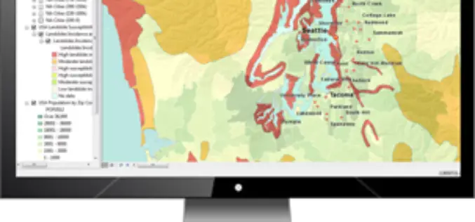
BLOOMINGTON, Ind. — The Indiana Geological Survey has published a new state map that features the latest digital technology using high-resolution elevation data. The map was prepared using lidar data
Geo-matching.com Adds Handheld Scanners Category
&bvsp; Lemmer, 30June 2015–Geo-matching.com has recently added Handheld Scanners to its broad spectrum of product categories.FARO Europe, DotProduct and Artec 3D Scannersare the first suppliers in this category.In addition to
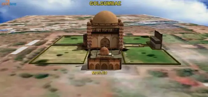
ISRO to Map and Create 3D Modelling of National Heritage Sites
Ministry of Culture, Government of India and Indian Space Research Organisation (ISRO) has collaborated to start a national project for inventory and monitoring of archaeological sites of the country. The
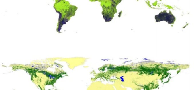
Global Forest Watch Using High Resolution Synthetic Aperture Radar
Forests always have been an important for all human beings and animals. For some forests provide shelter and some forests are source of livelihood. Monitoring global forest footprint is of
