
Tag "remote sensing"
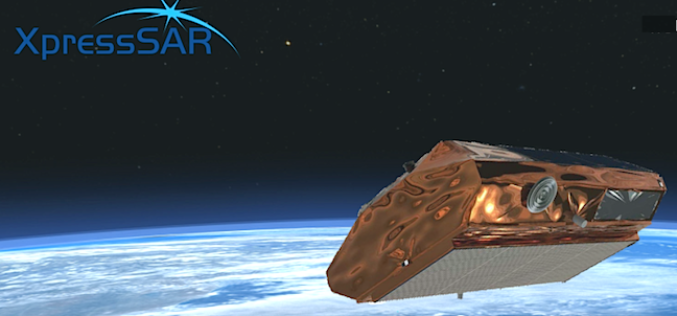
XpressSAR: High Revisit, High Resolution, All Weather SAR Satellite Constellation
XpressSAR Inc. is an American owned and operated company. XpressSAR will be a constellation of four small Synthetic Aperture Radar (SAR satellites with an average revisit rate of less than 4
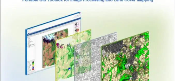
IMPACT: Open-source Software for Image Processing and Land Cover Mapping
The image processing and land cover mapping community can enjoy a new free software developed by the EU Joint Research Centre. The IMPACT tool is a portable browser-based application for
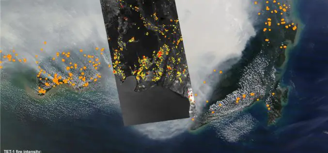
DLR Satellite TET-1 Delivers Detailed Images of the Fires in Indonesia
Indonesia is on fire – the island state is currently facing a bitter struggle against forest and peat fires on Sumatra and Borneo, most likely caused by illegal ‘slash and
Remote Sensing Technology to Monitor Crop Residue Management
Taking note of non-implementation of two advisories issued to curb burning of crop residues which was leading to smog in NCR region including Delhi, the Centre today asked four states

OGC and ASPRS to Collaborate On Geospatial Standards; Invite Participation in Point Cloud Work
The Open Geospatial Consortium (OGC) and the American Society for Photogrammetry and Remote Sensing (ASPRS) have agreed to work together more closely in the application and promotion of standards and best practices for the
Join Free Training on Bhuvan – Gateway to Geospatial World
Training on Bhuvan – Gateway to Geospatial World December 08 – 09, 2015 Bhuvan, (lit: Earth), is a software application which allows users to explore a 2D/3D representation of the
PhD candidate on Fingerprinting Remote Sensing Based Vegetation Types for Application in Global Vegetation Model
Leiden University (founded in 1575) is one of Europe’s leading international research-intensive universities. This prominent position gives our graduates an advantage when applying for positions both within and outside the
Ebook on Remote Sensing Applications
National Remote Sensing Center (NRSC) focusing on promotion of Remote Sensing Technology and Applications among users in India. The Centre is responsible for remote sensing satellite data acquisition and processing, data

China to Set Up 3 Civil Satellite Systems By 2020
BEIJING – China aims to finish building satellite systems for remote sensing, communications and navigation before 2020. The three satellite systems should be able to provide continuous and stable service,
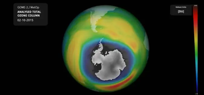
Ozone Hole Nears Record Size Again
The ozone hole over Antarctica currently extends over 26 million square kilometres – an area larger than the North American continent. Currently, it is approximately 2.5 million square kilometres larger
