
Tag "remote sensing"
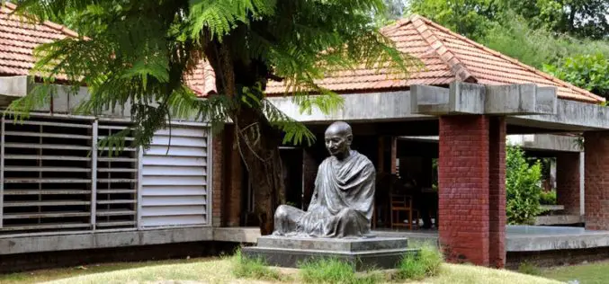
Gandhi Ashram Goes Under LiDAR Scan and Digitally Store
Mahatma Gandhi’s residence at Sabarmati Ashram – Hirday Kunj has under gone for LiDAR scanning to digitally store heritage building. This move has taken under a pilot project for the Gandhi
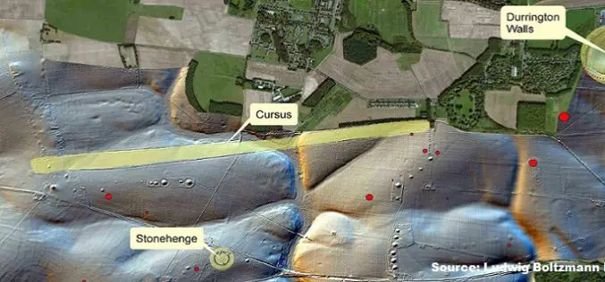
Geospatial Technology Helps To Find Remains of Major New Prehistoric Stone Monument
A team of researchers has found the remains of a major new prehistoric stone monument. They have been discovered less than 3 kilometres from Stonehenge. Using cutting edge, multi-sensor technologies

Webinar: Introducing the Trimble Remote Sensing Suite
Trimble has announced a new software solution, the Trimble Remote Sensing Suite. The new software suite enables geospatial professionals to efficiently extract high-quality information from satellite imagery for environmental, urban
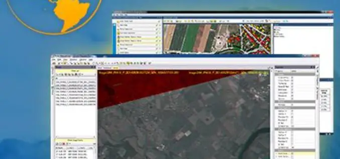
Trimble Transforms Satellite Data into Intelligence with its New Remote Sensing Suite
Customizable Data and Image Processing Software for Geospatial and Remote Sensing Professionals STUTTGART, Germany, Sept. 15, 2015—Trimble (NASDAQ: TRMB) announced today a new software solution, the Trimble® Remote Sensing Suite.
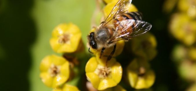
Remote Sensing Technology to Map Flowering Plants
Researchers from Finland, Kenya, South Africa and Sudan have created a flowering map for a semi-arid Savannah site in Africa using a new remote sensing technology. The remote sensing technology combines

China Launches Gaofen 9 Remote Sensing Satellite
China has launched Gaofen 9 remote sensing satellite at 04:45 UTC on Monday using Long March-2D launch vehicle from the 603 Launch Pad of the LC43 Launch Complex to orbit. It is
Master Geomatica from the comfort of your Home! 2015 Training Sessions on Now!
PCI Geomatics is the world leader in geo-imaging products and solutions. PCI Geomatics has set the standard in remote sensing and image processing tools offering customized solutions to the geomatics

Webinar on Transition of ENVI Analytics from Desktop to Web
Webinar on Transition of ENVI Analytics from Desktop to Web Tuesday, September 15, 2015 1:30 pm Singapore Time (Singapore, GMT+08:00) Geospatial imagery is used more and more across industries because
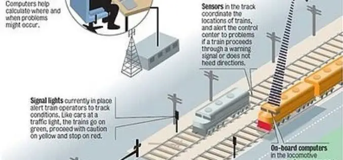
Indian Railways to Tie Up With ISRO for Enhanced Safety Using GPS Aided System (GAGAN)
Indian Railways will join hands with ISRO to get online satellite images for improving safety and enhancing efficiency. “We will undertake a massive exercise of GIS mapping of the entire

Remote Sensing Applications Webinar- NSW, RSPC
SSSI NSW are proud to present a webinar on “Remote Sensing Applications”. This webinar will cover interesting applications for satellite imagery. Dr Andrew Robson, from the University of New England,
