
Tag "USGS"
USGS Uses Remote Sensing for Groundwater Mapping in Kenya
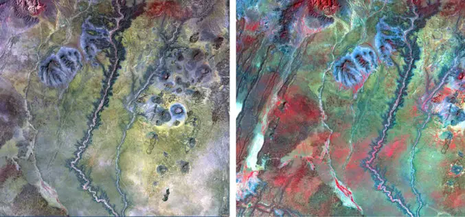
Groundwater mapping in Kenya has received a major boost through the use of remote sensing technologies, spearheaded by the U.S. Geological Survey (USGS), USAID, and Northern Arizona University. Remote sensing

USGS Advances Colorado Geological Mapping with Low-Flying Helicopters
The U.S. Geological Survey (USGS) has launched an extensive project to map Colorado’s geological history using low-flying helicopters equipped with sophisticated geophysical instruments. Starting in mid-August 2024, these flights will

USGS Developed High-Resolution Imagery of Coastal Wetlands to Identify Vulnerable Marshes across the US
Scientist have used a combination of remote sensing and satellite technologies to identify vulnerable marshes across the US.
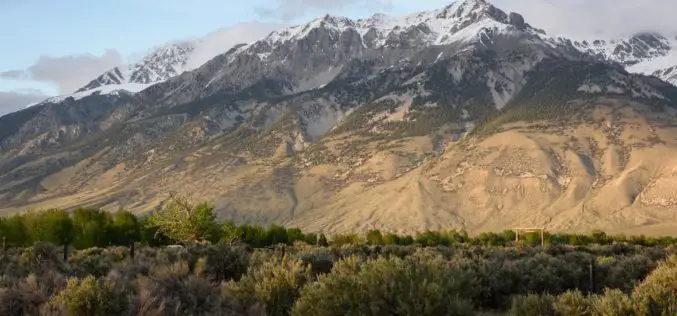
New Tool Allows Users to Explore Mountains Worldwide
A new tool that gives users the most detailed view yet of the world’s mountains is now available from the USGS. And it’s as close as your computer or cellphone.

South Dakota State University Ranks 27th in World for Remote Sensing Research
AUGUST 21, 2017 – South Dakota State University was ranked 27th worldwide and 7th in the United States for research productivity in the area of remote sensing, according to ShanghaiRanking’s 2017
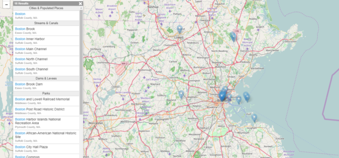
USGS Releases New JavaScript Library to Create Location Search Widgets for Web Applications
The U.S. Geological Survey Search API is a custom JavaScript library useful for creating a location search widget in a webpage, typically in conjunction with a web map. The widget connects to
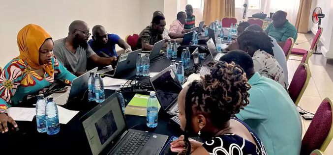
NAU Scientist Uses Remote Sensing to Detect Groundwater in Drought-stricken East Africa
Drought is a condition when a region notes a deficiency in its water supply whether surface or underground water. A drought can last for months or years, or may be declared
ISRO and USGS Signed MoU for Cooperation in Exchange on Remote Sensing Data
New Delhi, (PTI) – A Memorandum of Understanding (MoU) has been signed between Indian Space Research Organisation (ISRO) and United States Geological Survey (USGS) for cooperation in the exchange and
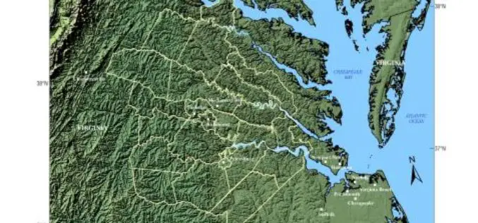
USGS -Building Unified Geospatial Data for Land-Change Modeling—A Case Study in the Area of Richmond, Virginia
Building Unified Geospatial Data for Land-Change Modeling—A Case Study in the Area of Richmond, Virginia Abstract – An effort to build a unified collection of geospatial data for use in
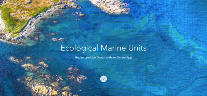
Esri Releases EMUs to Understand the Ocean
GIS Enables a New Way to Measure Marine Environments Redlands, California—Esri, the world leader in smart mapping technology, announced a whole new way of measuring the ocean on September 15,
