
Tag "USGS"
BLM, USGS Publish Data and Visualization Site for Sagebrush Geospatial Data
The Bureau of Land Management and the U.S. Geological Survey have published a hub to enable easy visualization and access to geospatial data about the west’s “sagebrush sea.” This will help
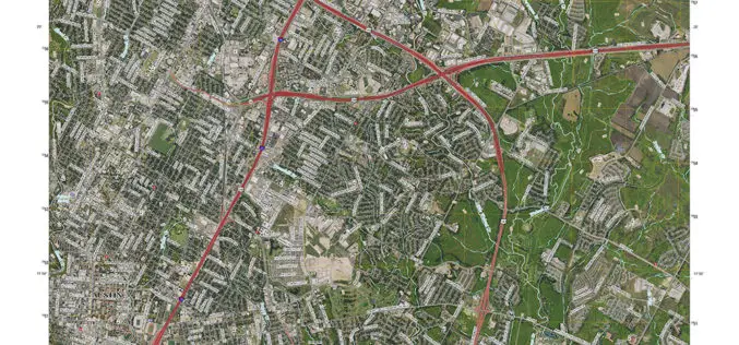
New Maps for Texas and Oklahoma Released
Updated US Topo maps for Texas and Oklahoma available for download; add Census Bureau road data, wetlands layer and select trails New US Topo maps for Texas and Oklahoma are
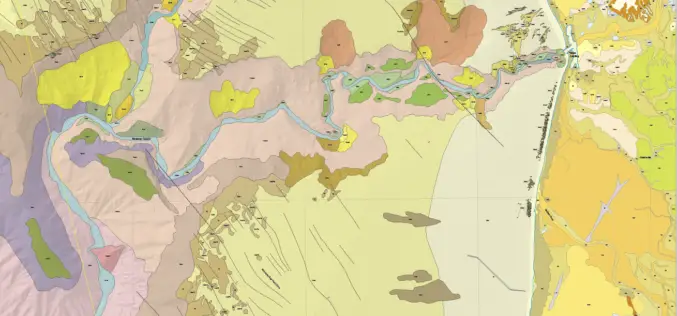
New Maps Illuminate Monterey Bay Area Seafloor
Six new sets of maps reveal the diverse and complex range of seafloor habitats along 130 kilometers (80 miles) of the central California coast from the Monterey Peninsula north to Pigeon

USGS Partners with European Space Agency to Deliver Copernicus Earth Data
The U.S. Geological Survey and the European Space Agency (ESA) have established an innovative partnership to enable USGS storage and redistribution of Earth observation data acquired by Copernicus program satellites.
New Maps of 2015 Floods Help S. Carolina Plan for the Future
The U.S. Geological Survey has created 20 new flood inundation maps that can help South Carolinians take steps to prevent or reduce future flood damage in the areas affected by
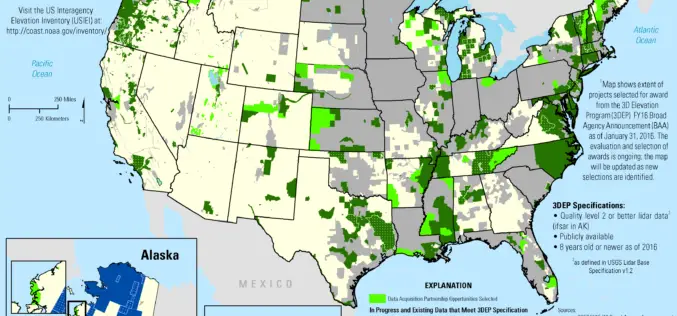
2016 Lidar Partnership Awards Announced
The U.S. Geological Survey has announced the first recipients of the 2016 partnership funding awards for the 3D Elevation Program. This program, referred to as 3DEP, presents a unique opportunity
Assessing the Socioeconomic Impact and Value of Open Geospatial Information
Assessing the Socioeconomic Impact and Value of Open Geospatial Information By: Francoise Pearlman, Jay Pearlman, Richard Bernknopf, Andrew Coote, Massimo Craglia, Lawrence Friedl, Jason Gallo,Henry Hertzfeld, Claire Jolly, Molly Macauley, Carl
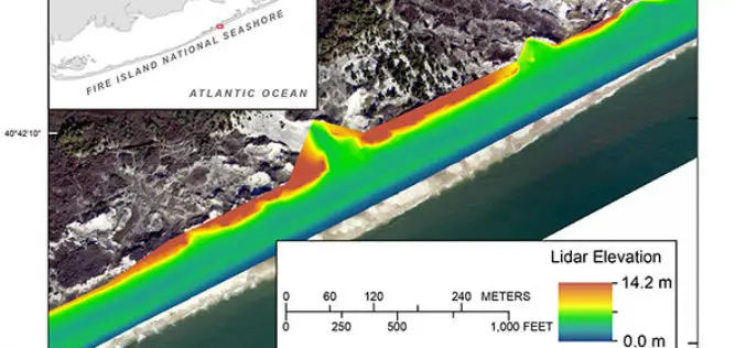
Terrestrial-based Lidar Beach Topography of Fire Island, New York
Abstract: The U.S. Geological Survey (USGS) St. Petersburg Coastal and Marine Science Center (SPCMSC) in Florida and the USGS Lower Mississippi-Gulf Water Science Center (LMG WSC) in Montgomery, Alabama, collaborated to
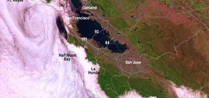
New California Fog Maps Reveal Pictures for Planning
A new series of maps of fog and low clouds covering the northern and central California coasts reveals daytime and nighttime patterns with a level of detail never previously mapped.

President’s 2017 Budget Proposes $1.2 Billion for the USGS
Reflects the ongoing commitment to scientific discovery and innovation to support decision making for critical societal needs WASHINGTON—The President’s fiscal year (FY) 2017 budget request for the U.S. Geological Survey
