
Tag "USGS"
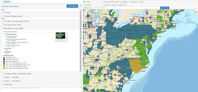
The National Map Data Download Enhancements
The USGS National Map program is transitioning all of its GIS data download capabilities to its new TNM Download client during the week of February 15, 2016. The new launch

USGS Increases Public Access to Scientific Research
The U.S. Geological Survey is implementing new measures that will improve public access to USGS-funded science as detailed in its new public access plan. The plan enables the USGS to
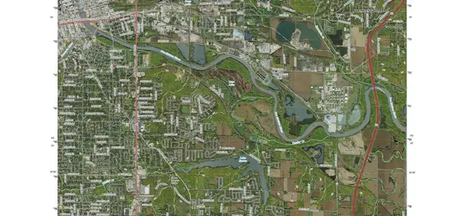
Updated US Topo maps for Iowa and Kansas released; add Census Bureau road data and PLSS
New US Topo maps for Iowa and Kansas are now available in the USGS Store for free download. The new maps of these Midwestern states feature the inclusion of the
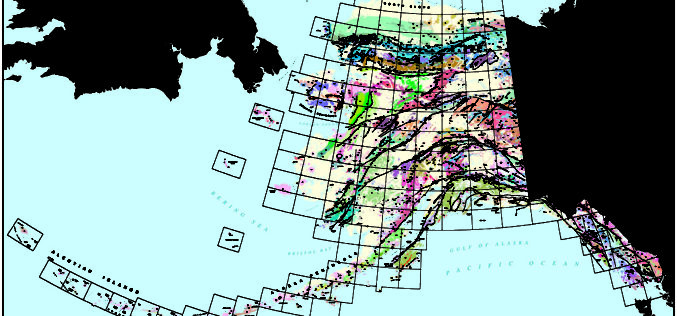
First Ever Digital Geologic Map of Alaska Published
ANCHORAGE, Alaska – A new digital geologic map of Alaska is being released today providing land users, managers and scientists geologic information for the evaluation of land use in relation to resource

OGC Announces New Arctic Spatial Data Infrastructure Project
The Open Geospatial Consortium (OGC®) announces a new OGC Interoperability Program project called the “Arctic Spatial Data Infrastructure Standards and Communication Pilot” (Arctic SDI Pilot). The Arctic SDI Pilot is

Low-Level Flights in Southeast Missouri Will Look at Geology and Mineral Resources
A high-resolution airborne survey to study the rocks within the St. Francois Mountains will be conducted by U.S. Geological Survey scientists starting this week. Over the next month, an airplane

Low-flying Airplane Mapping Geology and Mineral Resources Over the Eastern Adirondacks
Residents of Essex and Clinton counties in New York may notice an airplane flying a grid pattern at low altitude for a few weeks in December as scientists from the
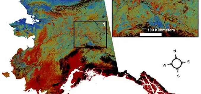
USGS Projects Large Loss of Alaska Permafrost by 2100
Using statistically modeled maps drawn from satellite data and other sources, U.S. Geological Survey scientists have projected that the near-surface permafrost that presently underlies 38 percent of boreal and arctic
Collect Points – Get The Patch
The USGS National Map Corps will award special edition patches for volunteers contributing 2,016 points between GIS Day 2015 and GIS Day 2016 Using crowdsourcing techniques, the USGS project known
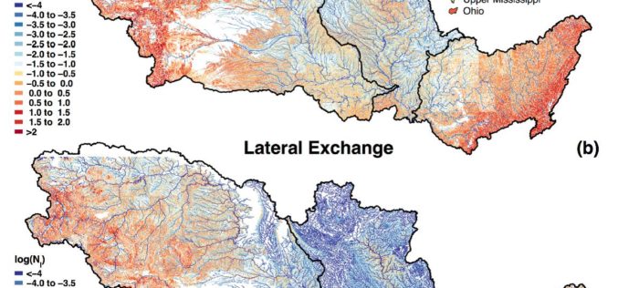
Uncovering the Mighty Mississippi’s Natural Potential for Nitrogen Removal
Working throughout the Mississippi River basin, USGS scientists and collaborators from the University of Texas at Austin have established the river’s own potential to decrease its load of nitrate and
