
Tag "USGS"

Joint Venture, U.S. Geological Survey Join Forces
Partnership to Tackle Earth and Atmosphere Challenges to Silicon Valley Joint Venture Silicon Valley and the U.S. Geological Survey today jointly announced a partnership to address regional challenges from natural

New Elevation for Nation’s Highest Peak plus 1 more
A new, official height for Denali has been measured at 20,310 feet, just 10 feet less than the previous elevation of 20,320 feet which was established using 1950’s era technology.
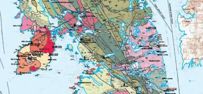
Geologic Map of Baranof Island, Southeastern Alaska Now Online
Alaska — In the 20th century, Baranof Island in Southeastern Alaska has drawn attention for its gold, chrome and nickel deposits, timber industry, potential activity of the dormant Mount Edgecumbe
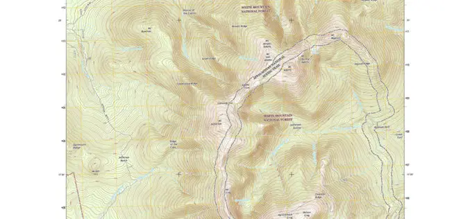
New England Maps Adding Trails
Newly released US Topo maps for New Hampshire, Vermont, Connecticut, Massachusetts and Rhode Island now feature selected trails and other substantial updates Several of the new US Topo quadrangles for

Mount McKinley Elevation Survey Results Coming Soon
Climbers return from the top of Mount McKinley to begin data analysis A team of four climbers has recently returned from the highest point in North America with new survey

USGS Welcomes European Space Agencys New Land Observing Satellite
The U.S. Geological Survey salutes the European Space Agency (ESA) on the successful June 23 launch of its Sentinel-2A satellite, the second satellite to be launched in Europe’s Copernicus environment

A New Era of Space Collaboration between Australia and U.S.
On June 18, 2015 in Canberra, Australia, the U.S. Geological Survey and Geoscience Australia signed a comprehensive new partnership to maximize land remote sensing operations and data that can help
USGS Webinar: Using The National Map Services to Enable Your Web and Mobile Mapping Efforts
USGS Webinar: Using The National Map Services to Enable Your Web and Mobile Mapping Efforts Are you a developer, firm, or organization using mobile or web applications to enable your

USGS Ups Ease of Use for Landsat Data
Landsat satellite data have been produced, archived, and distributed by the U.S. Geological Survey since 1972. Data users in many different fields depend on this basic Earth observation information to
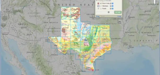
Interactive Geologic Map of Texas Now Available Online
Do you know where to find extinct volcanoes or where the dinosaurs once roamed in Texas? Can you find where unconventional oil and gas formations are present at the land
