
Tag "TerraGo"
TerraGo Webinar: How to Build Custom Cloud-Based, Enterprise Mobile Apps with Clicks Not Code
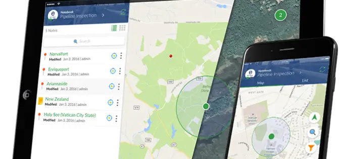
TerraGo Webinar: How to Build Custom Cloud-Based, Enterprise Mobile Apps with Clicks Not Code June 6, 2017 | 12:00 PM (ET) TerraGo Magic enables any organization to rapidly transform their
TerraGo Webinar: How to Build Custom ArcGIS Mobile Apps with Zero-Code
Webinar Workshop: How to Build Custom ArcGIS Mobile Apps with Zero-Code March 7, 2017 | 12:00 PM (ET) TerraGo Magic® enables anyone to rapidly build private-label, custom ArcGIS apps without the

TerraGo Joins Trimble Developer Partner Program and Includes Trimble GNSS Direct SDK in Mobile Products
TerraGo Edge® and TerraGo Magic® now include the Trimble® GNSS Direct SDK enabling professional-grade positioning with consumer ease of use for all types of field data collection, engineering, asset inspections

TerraGo Webinar: Building Custom Enterprise Mobile Apps with TerraGo Magic
Webinar: Building Custom Enterprise Mobile Apps with TerraGo Magic September 13, 2016 | 12:00 PM (ET) TerraGo Magic enables any organization to mobilize their unique business workflows by making it possible

Tap Into-High Accuracy GPS Data Collection
TerraGo and CHC Webinar: Tap Into High-Accuracy GPS Data Collection Date: January 26 at 11 AM CHC and TerraGo are revolutionizing the GPS data collection market by integrating CHC’s line of
Extend Microstation CAD Designs to Mobile Users with TerraGo Edge
Live Webinar: CAD Data In the Palm of Your Hand: Extend Bentley Microstation CAD Designs to Mobile Users with TerraGo Edge August 4, 2015, 12:00PM – 12:30PM (ET) More and more CAD users
Increase the Return on Your GIS Investment with GIS-Lite Applications
Increase the Return on Your GIS Investment with GIS-Lite Applications July 14, 2015 12:00-12:30 PM ET Deliver self-contained, interactive maps and lightweight GIS applications available to all end users with

TerraGo Webinar: Complex 2D & 3D Map Distribution Made Easy with TerraGo GIS-Lite Applications
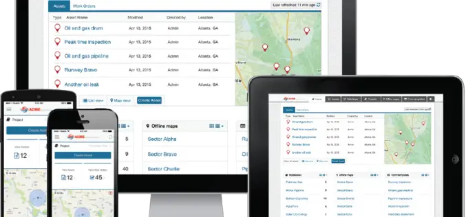
TerraGo Webinar: Complex 2D & 3D Map Distribution Made Easy with TerraGo GIS-Lite Applications May 5, 2015, 12:00 – 12:30 PM ET Oil & Gas companies deal with complex terrain and

TerraGo Publisher Version 6.7 Delivers Free GIS-Lite Applications from ArcMap
TerraGo Publisher for ArcGIS is an extension to Esri ArcGIS that allows you to produce and exploit GeoPDF documents with ArcMap. You can define global defaults to be used when
Webinar: Turn Your Mobile Device Into Survey Grade GPS
Turn Your Mobile Device Into Survey Grade GPS March 24, 2015, 12:00 – 12:30 PM ET There’s no need to continue to pay tens of thousand of dollars on single-use proprietary
