
Archive
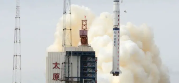
China Launches Yaogan-22 Remote Sensing Satellite
China launched the Yaogan-22 remote sensing satellite into scheduled orbit at 2:31 p.m. on Monday Beijing Time from Taiyuan Satellite Launch Center. The satellite will be used for scientific experiments,
Geotagging to Avoid False Damage Claims
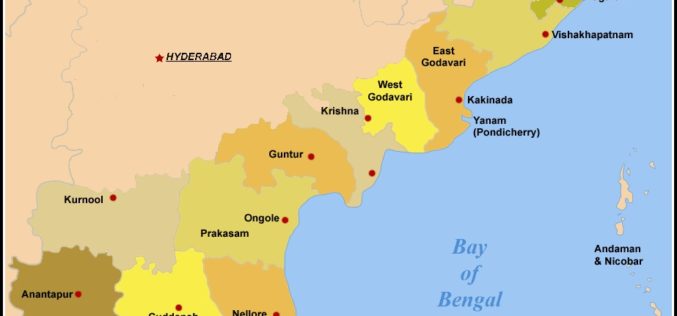
In recent news by The Indian Express, in his visit to Visakhapatnam post-Hudhud, Prime Minister Narendra Modi had suggested that the Andhra Pradesh State government use the latest technology to
GPS/GNSS Course by Coursera in Partnership with Stanford University
Coursera is an education platform that partners with top universities and organizations worldwide, to offer courses online for anyone to take, for free. Coursera envision a future where everyone has access
Telangana Goes for Satellite Mapping
According to recent news, the Telangana state government has started project to map state-owned land through satellite imageries. Tamil Nadu based Info Maps as has already began work on some
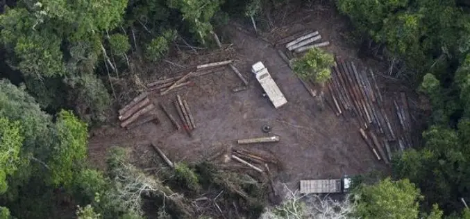
Activists Use GPS Systems to Track Illegal Logging Operations in Brazil’s Amazon Rainforest
The Amazon rainforest is the largest rainforest on earth. It covers 5% of the world’s surface area and reaches into nine South American countries. Deforestation normally starts with logging. Loggers

Chinese Scientist Proposes Series of 6 Satellites to Monitor Earth
Beijing , October 15, 2014, A Chinese scientist has proposed six new satellites to monitor “global change” or planetary scale changes concerning the Earth as well as human activity. Guo Huadong, dean

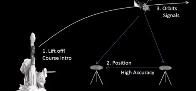
PSLV-C26 Successfully Lifted off India’s Third Navigation Satellite IRNSS-1C
Oct 16, 2014, ISRO’s Polar Satellite Launch Vehicle, PSLV-C26, successfully launched IRNSS-1C, the third satellite in the Indian Regional Navigation Satellite System (IRNSS), in the early morning hours of today
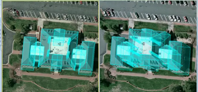
PCI Geomatics and IAVO-RS Announce Update to 3D FeatureXtract Software
PCI Geomatics, a world-leading developer of remote sensing and photogrammetric software and systems, announces with its partner IAVO, the release of 3D FeatureXtract (3DFE). By calculating feature heights and outlines
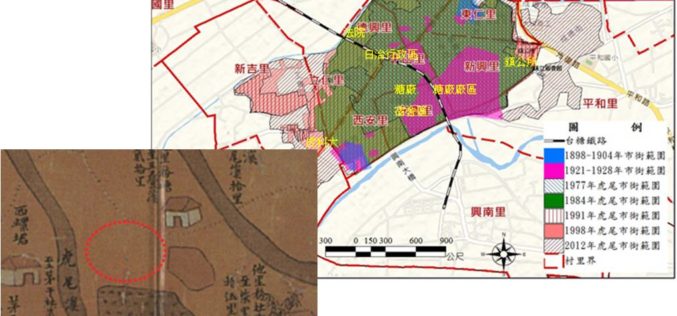
GIS Reappear Historical Township Maps
To better understand historical geospatial relations and complete the shortage of traditional historiography, which usually only uses textual materials, GIS technologies provide historians with modern method to rebuild the historical
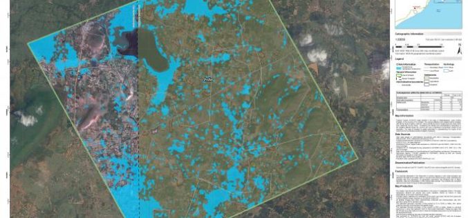
Copernicus Emergency Management Service release Flood Maps of Hudhud Affected Andhra Pradesh, India
Very Severe Cyclonic Storm Hudhud was the strongest tropical cyclone of 2014 within the North Indian Ocean, as well as the costliest storm in the basin since Cyclone Jal in 2010. Hudhud originated in
