
Archive
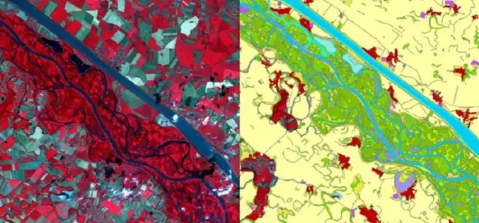
Copernicus: A Tool for Monitoring Europe’s Ecologically Sensitive River Banks
Riparian zones are fragile, yet environmentally important areas, and carry out a range of “ecosystem services”, such as filtering water, supporting wildlife and stabilising river banks. Within the Copernicus programme,

Global Mapper Webinar: What’s New in Global Mapper v. 16.1
What’s New in Global Mapper v. 16.1 February 19, 2015 at 2:00 pm (EST) The Global Mapper webinar for the month of February introduces the latest enhancements and improvements to
Salisbury University Offering Master’s in GIS Management
Salisbury University is a premier comprehensive Maryland public university with four privately endowed schools, offering excellent, affordable education in undergraduate liberal arts, sciences, business, nursing, education and social work and

Automatic Disaster Analysis and Mapping System Speed Up Earthquake Aid Response
The Automatic Disaster Analysis and Mapping system (ADAM) pulls information from the U.S. Geological Survey, World Bank and World Food Programme databases, getting aid workers vital facts from earthquake zones

Esri India Launches Smart Planning Tools for Smart Cities
Mumbai, India – Esri India (a joint venture between NIIT Technologies Limited, and Esri Inc.), country’s leading Geographic Information System (GIS) Software & Solutions provider, shared details of its offerings

New Book from Esri Shows How GIS Supports Weather, Climate Research
Redlands, California—Weather mapping goes beyond what’s broadcast on the evening news. The new book Mapping and Modeling Weather and Climate with GIS, from Esri Press, describes how geographic information system
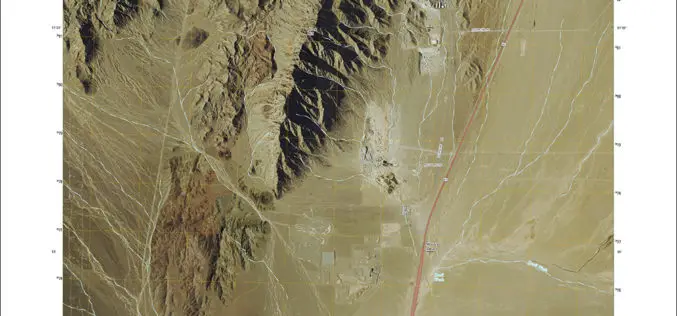
New US Topo Maps for Nevada Include Trails
Newly released US Topo maps for Nevada now feature selected trails. The data for the trails is provided to the USGS through a nation-wide “crowdsourcing” project managed by the International Mountain Biking

Cartoview Enterprise GeoSpatial Application Platform Release
Cartoview is an open source web framework for managing and deploying geospatial and business Applications, the architecture of Cartoview makes it easy to efficiently develop and maintain and deploy GIS

GIS to Map Schools Infrastructure in Telangana State
As reported by Deccan Chronicle, the government of Telangana is going to freshly map the exact infrastructure of the schools with the Geographic Information System (GIS). The maps will
Topcon Announces New Millimeter GPS Laser Transmitter
LIVERMORE, Calif., USA/ CAPELLE A/D IJSSEL, The Netherlands – 3rd February 2015 – Topcon Positioning Group announces the release of the next generation laser transmitter for use with its Millimeter
