
Archive
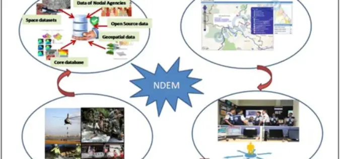
National Database for Emergency Management (NDEM) Services in Tackling Disasters
Towards supporting country’s efforts in efficient management of natural disasters, ISRO has evolved a comprehensive space-based Disaster Management Support (DMS) Programme and institutionalised the same in association with concerned ministries

China Plans to Build Remote Sensing Satellite Network with Global Coverage
China is planning to build a remote sensing satellite network with global coverage by setting up more ground stations overseas. The move will enable China to provide diversified data to foreign

Blue Revolution: GIS to Boost Fisheries Sector
According to recent news by BTvIn, Indian Prime Minister Narendra Modi has signed off a “Blue Revolution” with the approval of Rs 3,000 crore for the Integrated Development and Management

Applied Geodesy & Geographic Calculator Public Training
Applied Geodesy & Geographic Calculator Public Training This one day session covers the foundations and principles of Geodesy and mapping. Whether you’re an expert in GIS or just starting out,
Nepali Infrastructure Firm Chooses SuperGIS Desktop Professional
With the collaboration of Indian geospatial professional company, Satpalda Geospatial Services, the Nepali infrastructure firm in Kathmandu, Evernal Infrastructure Ltd., has selected SuperGIS Desktop 3.3 Professional and relevant extensions for

Low-Level Flights in Southeast Missouri Will Look at Geology and Mineral Resources
A high-resolution airborne survey to study the rocks within the St. Francois Mountains will be conducted by U.S. Geological Survey scientists starting this week. Over the next month, an airplane
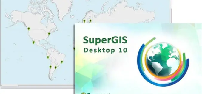
SuperGIS Desktop 10 Is Now Officially Unveiled!
Attention, GIS users! Supergeo Technologies is releasing the beta version of its all new GIS software—SuperGIS Desktop 10. Global users can now download this version directly from the official website
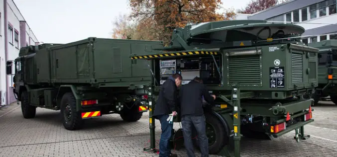
Airbus Defence and Space Completes First Mobile General Ground Station for NATO’s Alliance Ground Surveillance
Airbus Defence and Space has completed the first of its newly developed mobile general ground stations (MGGS) for the NATO’s Alliance Ground Surveillance (AGS). AGS is a NATO programme to

UN Expert Committee Outline the Future Trends in Digital Mapping
A new report setting out the five to ten-year vision of the rapidly growing geospatial information industry has been published by the United Nations Committee of Experts on Global Geospatial
Mobile App to Provide Real-time Information of Traffic in Abu Dhabi
According to the Gulf News, Darb mobile app launched by the Department of Transport (DoT), will make smartphones even smarter by helping motorists avoid congested roads and traffic delays through
